 © IDM Südtirol Alex Moling
 © Val Venosta Tourism
The Via Claudia Augusta cycle path runs along the ancient Roman road that leads from Germany through the Alps to the Adriatic Sea. The road took 60 years to build and was completed in 47 AD during the reign of Claudius Augustus. Initially the road was used for military purposes to facilitate supply, while in the following centuries it became an important commercial communication network. Two milestones, one in Rablà in the Vinschgau Valley and the other in Cesiomaggiore near Feltre (BL), still bear witness to this important undertaking.
Today, many history and nature enthusiasts undertake this long journey every year. It starts in Donauwörth in Germany, crosses the Alps via the Reschen Pass and continues to Meran, Bolzano and Trento, thus connecting three countries. From here the route branches off: one route leads to Ostiglia (FE), a river port on the Po, the other to Venice. From Germany to Venice the cycle path is 770 km long, to Ostiglia/Ferrara 735 km.
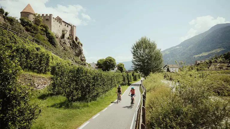
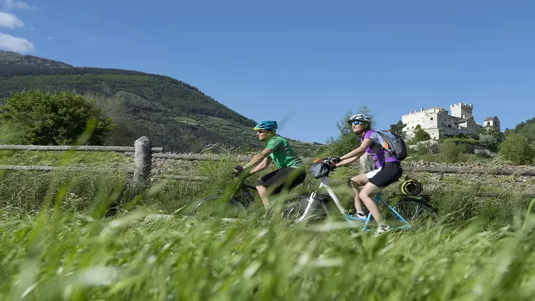
From Donauwörth the route heads south to Augsburg. From here, the route continues along gravel and country roads to Füssen and Biberwier and from there over the challenging Fernpass to Landeck in Austrian Tyrol. From Landeck the Via Claudia Augusta cycle path runs parallel to the Inn river as far as the Swiss border, from where it climbs to Nauders. After a 400‑metre ascent, you reach the Reschen Pass, the highest point of the route, and from here you enter Italy in the holiday region of Vinschgau. From Reschen, the Via Claudia Augusta cycle path coincides with the Adige cycle path to Meran. In the spa town, several cycle routes cross to Bolzano and the Val Passiria.
To continue along the Via Claudia Augusta, cyclists should take the cycle path at the Tel hydroelectric power station we take the cycle path on the Strada Vecchia di Lagundo, continue along the river to the outskirts of Merano, cross the Passirio bridge and continue through the Maia Bassa district, from where the cycle path enters the fruit orchards and continues through Lana-Postal to Bolzano.
The cycle path continues along the Adige River on an easy, family‑friendly route, passing the Piana Rotaliana, Mezzocorona and San Michele all'Adige to reach the centre of Trento. In Trento the cycle path splits. You can decide to continue towards Valsugana and Tesino. After the Croce d'Aune Pass you descend to the historic town of Feltre (BL). From here you have to cross the last pass, the Praderadego Pass, and descend towards the Prosecco hills and continue towards the Venetian plain to reach Altino.
The other route of the Via Claudia Augusta cycle route leads to the final stage at Ostiglia on the Po. From Trento the route goes on to Vallagarina and from there into the Valpolicella area, continuing through Verona to Ostiglia sul Po.
Departure: Donauwörth
Arrival: Venice (percorso est) – Ostiglia (percorso ovest)
Type of surface: gravel, asphalt, village and forest roads
Average gradient: 4 %
Maximum gradient: 12 %
Type of track: Family friendly in some sections, challenging routes for mtb experts in others
Traffic: Mixed, passing through some villages