 © Corradi | APT Valsugana
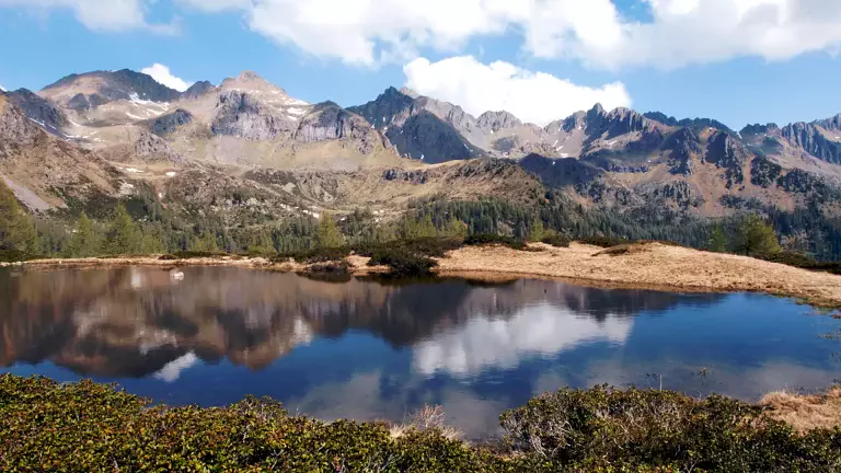
The Alta Via del Porfido is a four‑day circular trekking route that follows the ridges surrounding the Valle dei Mocheni / Bersntol – Fersental, offering spectacular views over the main peaks of Trentino–South Tyrol. The trail starts and ends in Palù dei Mocheni / Palai en Bersntol and partly follows the front lines of the First World War, making it an itinerary of great historical, cultural and geological interest.
The trek can be completed from June to September, clockwise or counterclockwise, and is recommended for hikers with good fitness and standard mountain equipment. It is advisable to start each stage early in the morning and to check hut availability in advance.
The Alta Via del Porfido includes three mountain huts:
- Rifugio Sprugio “G. Tonini”
- Rifugio Sette Selle
- Rifugio Erterle
Important note: the Rifugio Sprugio “G. Tonini” is currently destroyed and not operational. Before planning the itinerary, it is essential to check for alternative solutions and the updated conditions of the route.
Stages of the Alta Via del Porfido
Day 1 – Palù dei Mocheni → Rifugio Tonini
From the parking area in Lenzi (1350 m), follow trail 462 towards Passo Polpen, descend to Malga Stramaiolo, then take trail 443 to reach Rifugio Sprugio G. Tonini (1906 m). Time: 3h30 – Elevation gain/loss: +800 m / –200 m
Variant: ascent to Monte Ruioch (+1h30).
Day 2 – Rifugio Tonini → Rifugio Sette Selle
From the hut, follow trail 340 to Passo Val Mattio (2298 m), continue along the ridge between Passo Cagnon di Sopra, Monte Conca and Passo dei Garofani (2158 m), then descend to Rifugio Sette Selle (1978 m). Time: 3h30 – Elevation gain/loss: +520 m / –530 m
Variants:
- ascent to Monte Croce (+2h30)
- ascent to Cima d’Ezze via the equipped trail 340A Delio Pace (EEA, +2h40)
Day 3 – Rifugio Sette Selle → Rifugio Erterle
Follow trail 343 below the south faces of Sasso Rotto and Sasso Rosso to reach Forcella delle Conelle (2197 m). Continue along the ridge of Cima Cavè, Monte del Lago and Forcella del Lago, reaching Passo Portela (2152 m) via trail 325. Descend along trails 371 and 372 into Val Portela, reaching Cinque Valli and Rifugio Erterle. Time: 5h30 – Elevation gain/loss: +350 m / –920 m
Day 4 – Rifugio Erterle → Palù dei Mocheni
From the hut, climb to Forcella La Bassa, follow the ridge of Monte Fravort and Monte Gronlait (2383 m), descend to Passo Portela and then into Val Cava (1770 m). Take trail 324 up to Lago Erdemolo (2024 m), then follow trail 325 back to Palù dei Mocheni. Time: 6h30 – Elevation gain/loss: +1300 m / –1450 m Short variant: direct return via Passo Portela.
How to get there and where to park
From the SS47 Valsugana, exit at Pergine Valsugana and continue towards Valle dei Mocheni – Palù del Fersina. A large parking area is available in Palù.
Useful tips
Before starting the trek:
- check the weather forecast
- verify hut openings and availability
- start early to avoid afternoon thunderstorms