 © E.L.S. – Dolomiti.it
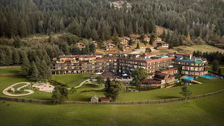
Covering 130 km of high‑altitude trails and more than 8,500 metres of elevation gain, the Tiroler Höhenweg is a demanding 11‑day journey through some of the wildest and most spectacular landscapes between Austria and South Tyrol. It offers silence, wide open spaces, encounters with fellow hikers, and the rare pleasure of travelling far from the usual tourist routes—a truly European long‑distance trail.
The route was officially inaugurated on 13 July 2002 in Vipiteno, the northern gateway to the Valle Isarco. For over two years, the Italian and Austrian Alpine Clubs worked together to link existing paths and create new sections, giving life to a cross‑border itinerary that adds an important chapter to the history of Alpine high routes.
Starting in Mayrhofen, in the Austrian Zillertal, the Tiroler Höhenweg was developed with European LEADER and INTERREG funding. The trail crosses more than a dozen passes and traverses 12 major mountain groups, including the Tribulaun massif, a dolomitic giant and symbol of the Upper Valle Isarco. From Mayrhofen, the route leads to the Schlegeis glacier basin, climbs to the Pfitscherjoch (Passo di Vizze), reaches the Landshuter Europahütte, continues over the Wolfendorn, and descends to the Brenner Pass. It then heads toward Obernberg and the Tribulaun area—where the French geologist Déodat de Dolomieu first identified the mineral composition of dolomite, long before the Dolomites themselves were named.
The trail continues through the historic mining area of Monteneve in Val Ridanna, crosses into Val Passiria, and finally descends toward Merano, passing below the peaks of the Texel Group.
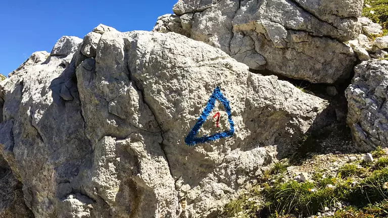
Throughout the journey, the route remains between 1,600 and 3,000 metres, alternating overnight stays in high‑mountain huts with nights in small valley villages. Hikers can also choose to walk individual stages, as the main trail is accessible from several points in the Valle Isarco, including the Brenner Pass, Val di Vizze and Val Ridanna. Those seeking a greater challenge can add extra stages, climb surrounding peaks or tackle via ferratas in the Tribulaun area. As renowned mountain guide Hans Peter Eisendle from Vipiteno says, the Tiroler Höhenweg is special for its solitude and deep silence.
Although demanding, the Tiroler Höhenweg is primarily a high‑altitude hiking route, not a mountaineering itinerary. Snowfields may persist even in summer—crampons and an ice axe can be necessary—and some exposed sections are protected with fixed cables. Good fitness, sure‑footedness and basic navigation skills are essential. For those who want to enjoy the experience to the fullest, hiring a certified mountain guide is highly recommended. A 1:50,000 trail map with route descriptions is available from the Valle Isarco Tourist Office.
Technical Data
- Start: Mayrhofen, Zillertal (Austria)
- Finish: Merano (South Tyrol, Italy)
- Length: approx. 130 km
- Elevation range: 1,600–3,000 m
- Difficulty: demanding high‑altitude hiking route
- Duration: 11 days
- Notes: individual stages can be walked separately