 © Associazione Turistica Val Passiria – Petr Blaha
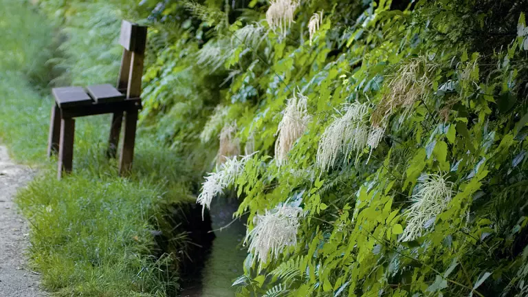
Around Merano, a dense network of paths runs alongside ancient irrigation channels that originated in the 13th century, when the region’s low annual rainfall forced farmers to build an extensive system of waterways to secure their crops. Water was diverted from rivers and streams and carried to the areas where it was most needed.
True monuments to rural ingenuity, many of these channels are still efficient and functioning despite the passing centuries. In the valleys they are called “Waal”, and the paths that run alongside them—originally used to monitor the water flow and carry out maintenance—became known as Waalwege.
Rediscovered and promoted for tourism, these Waalwege stretch for many kilometres and offer wonderful opportunities for hiking and walking. Around Merano there are about fifty of them. Generally flat and easy, the Waalwege are ideal for families and for anyone who enjoys relaxed walks. Along the way you will find inns, restaurants, and traditional taverns offering local specialities to those exploring these beautiful water trails.
The entire Merano Water Path covers 80 km and can be completed in 7–8 days, or walked in individual stages. There are eleven irrigation‑channel paths in the Merano area: the Waalwege of Lagundo, Caines, Rifiano, Maia, Scena, Brandis in Lana, Cermes, Marlengo, Parcines, Rablà and Naturno.
Brandis Waalweg in Lana
The Brandis Waalweg winds through chestnut groves, vineyards and apple orchards, offering a wonderful spectacle during the spring blossom. The route starts in Lana di Sopra, turning left from Via Palade. The walk crosses the grounds of the Lanegg convent and passes above the small church of St. Margherita before reaching the waterfall in Lana di Sotto. Walking time: 45 minutes
Parcines Waalweg
One of the oldest and most historically significant paths in the Burgraviato area, the Parcines Waalweg was built in the 15th century by the Counts von Stachelburg. Surrounded by birch woods and rich vegetation, it is still used to irrigate the orchards of Parcines. Walking time: 2 hours
Rablà Waalweg
The Rablà Waalweg is the shortest path in Merano and its surroundings, but also one of the most idyllic and family‑friendly. Walking time: 1 hour
Lagundo Waalweg
The Algunder Waalweg runs along the slopes above Lagundo and connects Tel with Tirolo. About 5–6 km long, it splits into two sections and is suitable for everyone. The western section starts from the car park near the Töllgraben bridge, easily reached by car or by the Lagundo–Parcines bus, and leads through the hamlets of Plars di Sopra and Plars di Mezzo to Lagundo village. From there, the path continues to Quarazze and the small church of Santa Maddalena. You can then choose to continue along the Tappeiner Promenade into the centre of Merano or return to Lagundo. Walking time: 1 hour
Marlengo Waalweg
At 13 km, the Marlinger Waalweg is the longest irrigation‑channel path in South Tyrol and one of the most panoramic, connecting the bridge at Tel with Lana. Walking time: 3 hours
Waalwege in Naturno
Around Naturno you will find some of the most beautiful irrigation‑channel paths in South Tyrol, such as the Stava, Latschander and Ciardes Waalwege.
Waalwege in Val Passiria
Val Passiria is home to four irrigation‑channel paths: the Waalwege of Caines, Rifiano, Maia and Ulfas. Easy and without significant elevation gain, with walking times between 1.5 and 3 hours, they can be enjoyed all year round and are suitable even for families with small children.