 © kordi_vahle | Pixabay
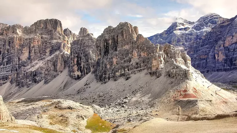
The Lagazuoi Lake lies on the edge of the Cadin di Lagazuòi, nestled between the rock faces of Cima del Lago, Cima Scotoni and the Fànis peaks. A spectacular environment where nature, history and geology meet, surrounded by remains of the First World War, trenches and unique Dolomite landscapes.
How to reach Lagazuoi Lake from Rifugio Lagazuoi
Start and finish: Rifugio Lagazuoi – Cortina d’Ampezzo
From Passo Falzàrego, take the cable car up to Lagazuoi Piccolo, reaching the mountain hut of the same name. The hike begins here.
Descent towards Forcella Lagazuoi – Trail 401
Follow trail 401, which descends quickly to Forcella Lagazuoi, a panoramic viewpoint over the Tofane and the Fanes group.
Towards Lagazuoi Lake – Trail 20
At the saddle, continue along trail 20, keeping right at the fork. The descent (about 400 m of elevation loss) crosses a rocky valley between alpine meadows and the Dolomite walls of Lagazuoi Grande and the Fanes peaks.
Shortly afterwards, you reach Lagazuoi Lake, located in the territory of San Cassiano – Alta Badia.
Return via Rifugio Scotoni – Trails 20, 18B and 20A
Climb back up along trail 20 to Rifugio Scotoni (2,040 m). From the hut, follow trail 18B to Forcella Salares, then take trail 20A, which leads back to Forcella Lagazuoi and the cable car station.
Technical data of the itinerary
- Difficulty: medium (EE in some steep sections)
- Elevation gain/loss: approx. 400–500 m
- Duration: 3.5–4.5 hours
- Points of interest: Lagazuoi Lake, Rifugio Lagazuoi, Rifugio Scotoni, WWI trenches and tunnels, views over Fanes and Lagazuoi Not suitable for MTB