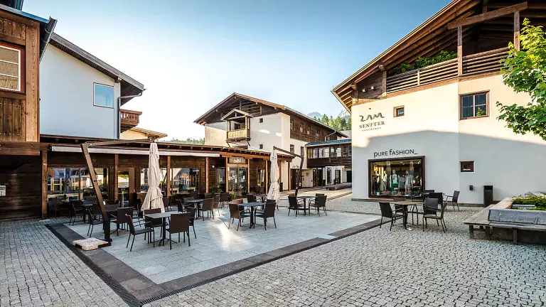
 © Angela Pierdonà
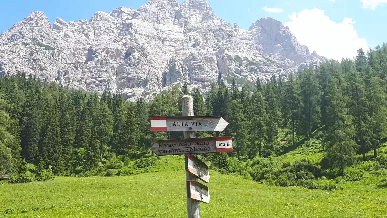
The Dolomites High Route No. 1, known as the classic route, follows a spectacular 12‑stage itinerary of about 125 km, connecting Lake Braies to Belluno. Crossing the very heart of the Dolomites—from the Pusteria Valley (South Tyrol) to the foothills of the Veneto plain—this legendary trail leads through the Dolomites of Braies, Cortina d’Ampezzo, Val di Zoldo, Agordino and Belluno, offering breathtaking landscapes and unforgettable hiking experiences. The route is well signposted and generally not overly technical, with the more challenging sections equipped or protected.
The northern section begins at the enchanting Lake Braies and enters the romantic kingdom of Fanes, continuing toward the Tofane. Here, experienced hikers can tackle exciting via ferrata routes. Following the easier trail, the itinerary descends into the beautiful Zoldo Valley, dominated by the majestic presence of Mount Pelmo. Hiking across the Civetta Group offers some of the most spectacular views in the entire Dolomites. The route concludes in the green and peaceful Valbelluna.
echnical Data | Dolomites High Route No. 1
Start: Lake Braies (BZ)
Finish: Belluno
- Total duration: 12 days
- Total length: approx. 125 km
- Mountain huts on the main route: 15
- Bivouacs: 1
- Food/refreshment points: 6
- Longest stage: Palafavera → Lagazuoi Hut (Stage 7), 6 hours
- Shortest stage: Lake Braies → Biella Hut (Stage 1), 3h 30min
- Total hiking time: approx. 57 hours
- Difficulty: medium to high
- Total ascent: approx. 7,300 m
- Total descent: approx. 8,400 m
- Maximum ascent in one stage: 1,070 m (Fanes → Lagazuoi, Stage 3)
- Maximum descent in one stage: 1,900 m (Marmol → Belluno, final stage)
- Highest point: Lagazuoi Hut, 2,752 m
- Lowest point: Belluno, 389 m (Case Bortot 568 m)
- Dolomite groups crossed: 11
- Mountain hut opening period: June–September
- Signage: excellent throughout
Recommended period: late June to late September
Recommended Maps | Dolomites High Route No. 1
Tabacco 1:25,000 maps
- No. 031 – Dolomiti di Braies (Lake Braies → Fanes Hut)
- No. 03 – Cortina d’Ampezzo (Biella Hut → Ambrizzola Saddle)
- No. 015 – Marmolada–Pelmo–Civetta–Moiazza (Falzarego Pass → Carestiato Hut)
- No. 025 – Zoldo, Cadorine and Agordine Dolomites (Ambrizzola Saddle → Marmol Bivouac)
- No. 024 – Prealpi e Dolomiti Bellunesi (Marmol Bivouac → Belluno)
Stage 1: Lake Braies – Biella Hut – Croda del Becco
- Elevation gain: 900 m | loss: 60 m
- Length: approx. 6 km
- Hiking time: 3h 30min
- Trail: No. 1
- Difficulty: Easy–Moderate
Stage 2: Biella Hut – Fanes Hut
- Gain: 565 m | loss: 830 m
- Length: approx. 14 km
- Time: 4h 30min
- Trails: No. 6, 7
- Difficulty: Easy
Stage 3: Fanes Hut – Lagazuoi Hut
- Gain: 1,070 m | loss: 375 m
- Length: approx. 11 km
- Time: 5h
- Trails: No. 10–11, 20b, 20
- Difficulty: Trekking
Stage 4: Lagazuoi Hut – Nuvolau Hut
- Gain: 636 m | loss: 810 m
- Length: approx. 15 km
- Time: 5h 30min
- Trails: No. 20, 401, 402, 403, 412, 440
- Difficulty: Trekking Alternative: Castelletto Tunnel Route
Stage 5: Nuvolau Hut – Città di Fiume Hut
- Gain: 260 m | loss: 915 m
- Length: approx. 11 km
- Time: 4h 30min
- Trails: No. 438, 443, 436, 458, 467
- Difficulty: Trekking / Equipped sections Alternatives: via Cinque Torri or Croda da Lago
Stage 6: Città di Fiume Hut – Venezia Hut – Palafavera
- Gain: 580 m | loss: 990 m
- Length: approx. 12 km
- Time: 5h 30min
- Trails: No. 480, 472, 474
- Difficulty: Hiking / Equipped sections (Gino Flaibani path)
Stage 7: Palafavera – Coldai Hut – Tissi Hut – Vazzoler Hut
- Gain: 850 m | loss: 650 m
- Length: approx. 14 km
- Time: 6h
- Trails: No. 564, 556, 560 (563)
- Difficulty: Hiking
Stage 8: Vazzoler Hut – Carestiato Hut
- Gain: 550 m | loss: 430 m
- Length: approx. 8 km
- Time: 4h
- Trails: No. 555, 554
- Difficulty: Hiking
Stage 9: Carestiato Hut – Sommariva al Pramperét Hut
- Gain: 450 m | loss: 430 m
- Length: approx. 13 km
- Time: 5h
- Trails: No. 549, 543
- Difficulty: Hiking
Stage 10: Sommariva Hut – Pian de Fontana Hut
- Gain: 540 m | loss: 760 m
- Length: approx. 6 km
- Time: 3h
- Trail: No. 514
- Difficulty: Trekking
Stage 11: Pian de Fontana Hut – 7° Alpini Hut
- Gain: 830 m | loss: 195 m
- Length: approx. 7.5 km
- Time: 7h
- Trail: No. 514
- Difficulty: EE–EEA (via ferrata sections) Variant available to avoid the via ferrata
Stage 12: 7° Alpini Hut – Case Bortot – Belluno
- Gain: 100 m
- Length: approx. 12 km
- Time: 6h
- Trail: No. 501
Important Note
Before starting the route, always check weather conditions, mountain hut openings, and availability.