The Mario Zandonella Via Ferrata, combined with the equipped trail on the northern side of Croda Rossa, is one of the most spectacular and complete routes in the Sesto Dolomites. It is a demanding itinerary, rich in history and breathtaking scenery, ideal for experienced hikers seeking an authentic adventure in the heart of the Popera Group.
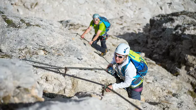
Ascent – Mario Zandonella Via Ferrata (south face)
From the Passo della Sentinella, the route descends into the evocative Vallon Popera, following the signs leading to the start of the via ferrata. The climb rises steeply through a narrow and rugged gully, alternating athletic moves with highly exposed sections.
At around 2,800 m you reach a historic Italian military outpost of the Battaglione Fenestrelle, a remarkable relic of the First World War. Beyond this fortified point, the route continues toward the summit ridge of Croda Rossa, which is reached at 2,936 m, offering sweeping views over the entire Popera Group.
Descent – Equipped Trail (north side)
The descent follows the northern slope along the partially equipped normal route: a less technical but long path that requires sure footing and steady attention. The trail leads to the wide plateau of the Prati di Croda Rossa, from where you can comfortably return to Moso (Sesto Pusteria) by cable car.