The Via Ferrata Laurenzi is a high‑altitude route that connects the Rifugio Alpe di Tires with the enchanting Lago d’Antermoia, following a long panoramic ridge suspended between some of the most iconic Dolomite peaks. It is a fascinating and demanding itinerary, ideal for experienced hikers seeking an authentic adventure far from the more crowded trails.
Route Description
From the Rifugio Alpe di Tires, follow the path towards Passo Molignon, leaving the main trail about 250 metres before the pass. A clear, well‑marked track in excellent condition leads in just a few minutes to the first equipped section, where the more technical part of the route begins.
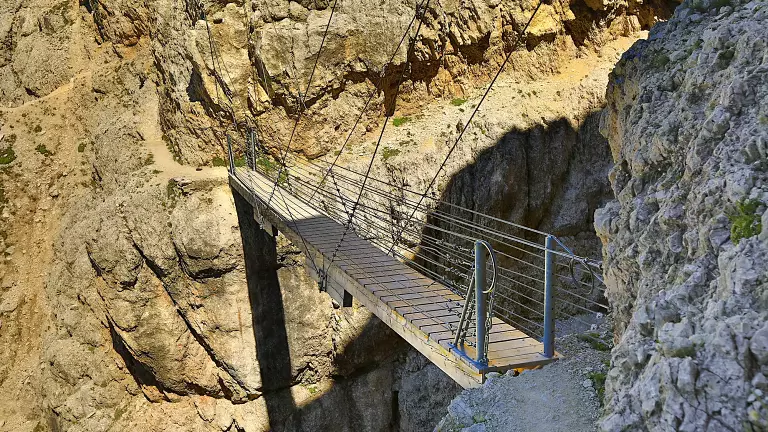
The ferrata develops along the Molignon ridge, alternating short stretches with steel cables and long, unprotected sections that are always very exposed. The ascent leads to the wide summit plateau of the north‑western Molignon, reaching the peak at 2778 m, a natural balcony offering breathtaking views over the Dolomites.
From here, continue eastwards to reach the start of the true ferrata (around 2760 m). The most delicate passages are protected by cables, while the rest of the route requires sure‑footedness, constant attention and confidence on exposed terrain. The ridge alternates ascents and descents, with some sections of easy scrambling.
The final descent takes place on the southern side, along a steep but well‑marked path that leads directly to Lago d’Antermoia, one of the most evocative places in the Catinaccio group.