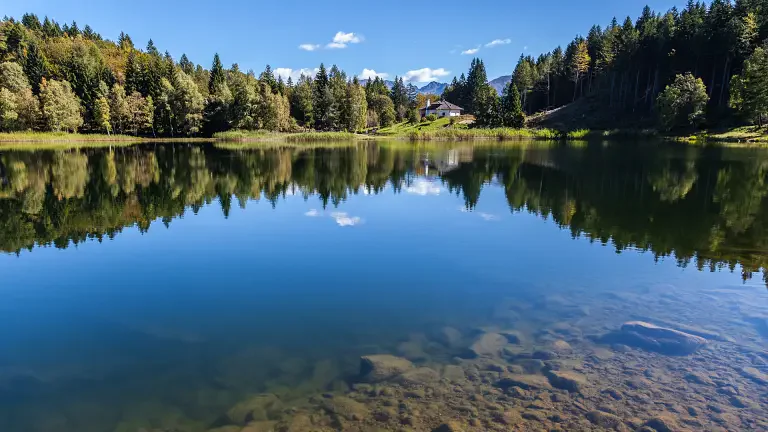
 © Rete Riserve valle di Cembra | Alessandro Cristofoletti
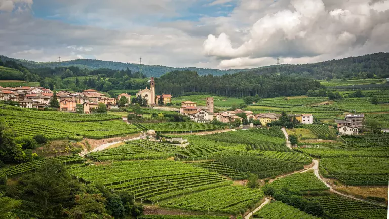
A 3-day trekking adventure through the Upper Cembra Valley and the Monte Corno Nature Park, surrounded by silent forests, ancient peat bogs, alpine lakes and unspoilt landscapes.
This hiking itinerary is ideal for anyone looking to experience the mountains away from the busiest trails, discovering a territory renowned for its biodiversity, natural habitats and fascinating traces of the past.
You will not encounter towering rock faces or inaccessible peaks. Instead, you will discover a quieter and perhaps less spectacular, yet equally precious, side of the mountains: the forests separating the Adige Valley from the Cembra Valley.
This borderland has been a place of passage since Roman times, and along the way you will encounter both natural and cultural evidence of the mountain's past.
Among the most fascinating features are the alpine peat bogs, ancient glacial lakes gradually transformed by the accumulation of peat. Today, these wetlands provide unique habitats for a remarkable variety of plant and animal species.
The route also reveals traces of traditional mountain life, including bird-catching towers, old mills, boundary markers, alpine farms and mountain refuges, telling stories of a landscape shaped by people over centuries.
At the end of each day, the warm atmosphere of a mountain refuge or alpine farm awaits. A steaming bowl of soup, local specialities and a glass of wine are the perfect way to relax, remember the day's adventures and look forward to the next stage.
Trekking in the Cembra Valley and Monte Corno Nature Park: route information
Duration: 3 days
Area: Upper Cembra Valley – Monte Corno Nature Park
Difficulty: Moderate mountain hike (E – hiking trail classification)
Recommended season: Late spring to autumn, always checking trail conditions and refuge opening dates
Highlights: Alpine peat bogs, Santo Lake, Lagabrun Nature Reserve, Weißensee, Schwarzensee, Potzmauer Refuge, Trudner Horn Alpine Farm and the Dürer Trail
Stage 1 – From Pochi di Salorno to Potzmauer Refuge
Distance: 18.4 km
Walking time: approx. 6 hours (excluding breaks)
Elevation gain: 1,200 m
Elevation loss: 450 m
The first stage starts in Pochi di Salorno, a small mountain village overlooking the Adige Valley.
From near the church, follow the scenic Dürer Trail (Dürerweg) and the signs towards Sauch Refuge. The route initially descends through woodland and countryside before climbing along trail no. 1 to Sauch Refuge, at 946 m.
From here, the route continues along a forest road towards Santo Lake, passing the characteristic bird-catching tower and reaching Passo della Croccola.
Following trail no. 409, you climb through a beautiful fir forest to the Lagabrun Nature Reserve, one of the most valuable wetland habitats in the area.
The trail then continues towards Santo Lake (1,206 m), surrounded by the forests of the Cembra Valley.
From the lake, the route climbs towards the Vegiose meadows and Passo Zise, before descending towards the Valda Lake area.
The final section follows a forest road to Potzmauer Refuge, at 1,282 m, where the first day's hike comes to an end.
Stage 2 – From Potzmauer Refuge to Trudner Horn Alpine Farm
Distance: 12.8 km
Walking time: approx. 4 hours 15 minutes (excluding breaks)
Elevation gain: 750 m
Elevation loss: 350 m
The second stage takes you deeper into the protected landscapes of the Monte Corno Nature Park.
From Potzmauer Refuge, climb towards Potzmauer Pass and follow the signs to Lac del Vedes (1,496 m).
The trail runs alongside the nature reserve before continuing along a forest road towards the mountain huts and the Valdonega crossroads.
From here, the route climbs towards Doss da l'Ors. A short detour leads to a panoramic viewpoint with a mountain hut.
Continuing through a spruce forest, the trail reaches another junction before heading towards the Monte dell'Orso basin and Cauria (Gfrill).
From Valdonega, an alternative route follows the evocative Trail of the Borders (Sentiero dei Confini) towards Cauria.
The main route continues towards Weißensee, one of the area's most fascinating high-altitude wetlands. From the lake, a forest road leads around the wetland before continuing towards Schwarzensee.
From Schwarzensee, the trail descends for around 30 minutes to the Trudner Horn Alpine Farm, where you can end the day surrounded by the peaceful landscape of the Monte Corno Nature Park.
Stage 3 – From Trudner Horn Alpine Farm to Pochi di Salorno
Distance: 12.9 km
Walking time: approx. 3 hours 45 minutes (excluding breaks)
Elevation gain: 300 m
Elevation loss: 1,450 m
The final stage brings you back to the starting point through the wild forests of the Monte Corno area.
From the alpine farm, follow trail no. 9 towards Hackelboden and Gschnon (Casignano), passing below the summit of Monte Corno (Trudner Horn, 1,781 m).
The trail crosses the beautiful Gschnon Forest (Selva di Casignano) before descending through woodland along a well-marked path.
The route reaches the Hackelboden mountain hut and then continues towards Cauria (Gfrill) and the Gfrill Pass.
From the pass, a short descent leads to the mountain village of Cauria. The trail then continues towards Laghetti (Laag), entering a narrow and peaceful valley.
After passing the historic stone bridge, the route joins the Dürer Trail, which climbs from the Klösterle area of Laghetti and finally brings you back to Pochi di Salorno (Buchholz).
The 3-day trekking adventure ends here, after an itinerary combining protected nature, alpine landscapes, history and authentic mountain culture.
A trekking experience to enjoy slowly
The 3-day trek between the Cembra Valley and Monte Corno Nature Park is an ideal experience for hikers looking for nature, tranquillity and authenticity.
A journey through Trentino and South Tyrol forests, alpine lakes, peat bogs, nature reserves and traditional mountain refuges, where every step reveals a landscape that has remained remarkably authentic.