 © Vinschgau Marketing – Frieder Blickle
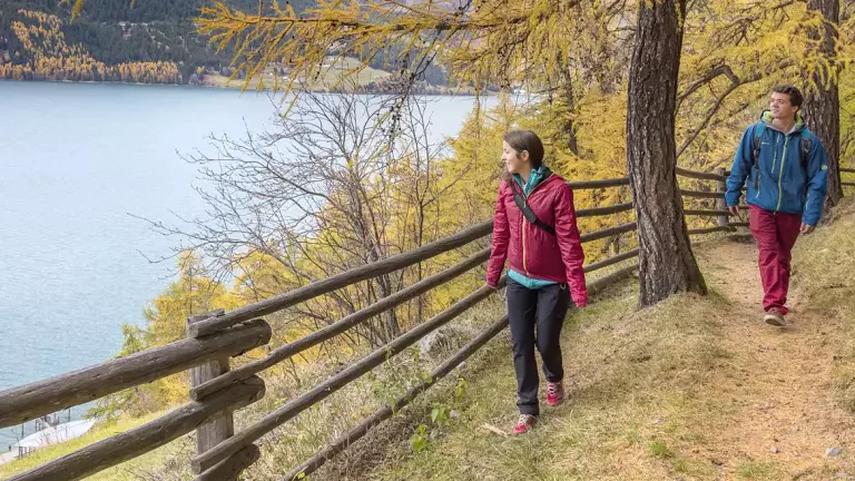
The Venosta Valley High Mountain Trail is a must‑do route for experienced hikers and lovers of long‑distance trekking. The trail stretches from the source of the Adige River at the Resia Pass down to Stava, a hamlet of Naturno in the lower Venosta Valley. It offers panoramic views over the valley and impressive vistas of the Ortler mountain group.
This 108‑km long‑distance trail follows several sections of the Monte Sole route, alternating between challenging mountain paths and the characteristic Waalwege (historic irrigation‑ditch trails). Each stage can be completed as part of a multi‑day trek or as an individual day hike. The ascents and descents are well signposted, making the trail accessible from many villages along the valley.
The Venosta Valley High Mountain Trail can be hiked clockwise or counterclockwise from April to October. Good fitness, hiking experience, and standard mountain equipment are required.
Technical data
- Starting point: Stava (Naturno)
- Ending point: Resia – source of the Adige River
- Duration: 5 days
- Trail length: approx. 108 km
- Total ascent: approx. 5,600 m
- Total descent: approx. 4,600 m
- Best season: April–October
Recommended maps
Tappeiner 1:50,000 – Alta Via Val Venosta
Stages
Stage 1: Stava → S. Martino al Monte / Laces
- Ascent: 1,440 m
- Descent: 1,330 m
- Length: approx. 25 km
- Hiking time: 8 h 30 min
- Trail markers: no. 1–2
- Landmarks: Stava – Senales Waalweg – Platzfair – S. Martino al Monte
Stage 2: S. Martino al Monte / Laces → Tanas / Lana
- Ascent: 1,430 m
- Descent: 252 m
- Length: approx. 12.7 km
- Hiking time: 5 h 30 min
- Trail markers: no. 14
- Landmarks: S. Martino al Monte – Egg – Talaccio – Paflur
Alternative Stage 2: S. Martino al Monte / Laces → Corces / Silandro
- Ascent: 193 m
- Descent: 1,087 m
- Length: approx. 12 km
- Hiking time: 5 h
- Trail markers: no. 5
- Landmarks: S. Martino al Monte – Egg – Ilswaal – Corces
Stage 3: Tanas / Lana → Glieshöfe farms (Mazia / Malles)
- Ascent: 1,080 m
- Descent: 800 m
- Length: approx. 22 km
- Hiking time: 7 h
- Trail markers: no. 21–23
- Landmarks: Paflur – Glieshöfe farms – Gschneir Waal – Glieshöfe farms
Stage 4: Glieshöfe farms → Planol / Malles via Monteschino
- Ascent: 1,177 m
- Descent: 1,417 m
- Length: approx. 29.4 km
- Hiking time: 8.5–9 h
- Trail markers: no. 21–23
- Landmarks: Glieshöfe farms – Mazia Alpine Hut – Gonda Alpine Hut – Monteschino – Malettes – Planol
Alternative Stage 4: Glieshöfe farms → Planol / Malles via Piz Lun
- Ascent: 1,100 m
- Descent: 1,340 m
- Length: approx. 21 km
- Hiking time: 7 h
- Trail markers: no. 13
- Landmarks: Glieshöfe farms – Mazia Alpine Hut – Gonda Alpine Hut – Piz Lun – Planol
Stage 5: Planol / Malles → Source of the Adige River (Resia Pass)
- Ascent: 850 m
- Descent: 880 m
- Length: approx. 19.6 km
- Hiking time: 9 h
- Landmarks: Planol – Alsago – Piavenna – Arlund – Curon – Adige River source
Alternative Stage 5: Planol / Malles → S. Valentino → Belpiano → Adige River source
- Ascent: 1,450 m
- Descent: 890 m
- Length: approx. 21.4 km
- Hiking time: 7 h
- Landmarks: Planol – Ultimo – Alsago – Piavenna – Malga S. Valentino – Belpiano – Adige River source
How to reach the trail
- Ciardes: trail no. 3
- Colsano: trail no. 1b–3
- Laces: S. Martino cable car
- Coldrano: trail no. 5
- Vezzano: trail no. 16
- Silandro: trail no. 11
- Corzes: trail no. 5
- Alliz: trail no. 19
- Tanas: trail no. 25
- Spondigna: trail no. 22–23a
- Sluderno: trail no. 21
- Tarces: trail no. 18
- Malles: trail no. 12
- Planol, Ultimo, Alsago, Piavenna
- S. Valentino: trail no. 3–6
Parking
- Stava: village center, free and unattended
- Resia: sports field, free and unattended
Note:
Before starting the trail, check the weather forecast and verify the availability of accommodation along the Venosta Valley High Mountain Trail.