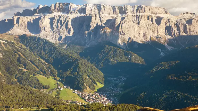
 © Shutterstock
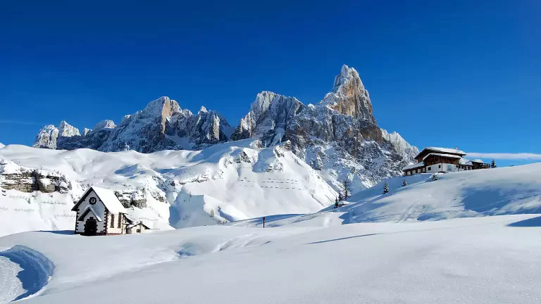
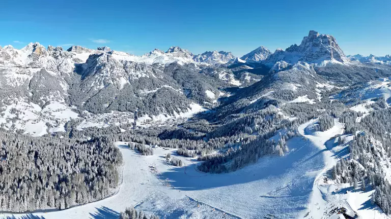
This great alpine itinerary, similar to Alta Via n.1, runs along the ridges from the Isarco Valley to the Piave, passing from the northern edges of the Dolomites to the pre-Alps overlooking the Veneto plain, and connects two enchanting alpine towns: Bressanone and Feltre. The itinerary crosses three provinces, Bolzano, Trento and Belluno, and passes through 8 Dolomite groups, from the Sella massif to the Marmolada and the Pale di San Martino group, as far as the Feltre Alps. This long hike, which takes an average of a couple of weeks, can be completed by those with excellent fitness, a good sense of orientation and basic mountaineering skills.
Alta Via n.2 is also known as "The Route of Legends", following the myths and stories handed down by local people: from the rock walls of the Odle, the mythical realm of the characters of the Ladin sagas, to the remote, high glacial basins of the Vette Feltrine.
Notes: this route is recommended especially for the most experienced hikers, who do not suffer from vertigo and have a strong sense of orientation. Minimal mountaineering knowledge is also required to tackle some difficult sections.
Technical data
Route: Bressanone (BZ) - Feltre (BL)
Days of travel: 13
Route length: 180 km
Huts along the main route: 14
Bivouacs along the main route: 2
Refreshment points along the main route: 15
Longest stage: from Bivacco Feltre to Rifugio Dal Piaz – 11th stage, travel time – 9 hours
Shortest stage: from Rifugio Treviso to Passo Cereda – 9th stage, travel time – 4 hours and 30 minutes
Total travel time: about 80 hours
Difficulty: from easy to demanding
Total ascent: 11300 m
Total descent: 11200 m
Maximum ascent: 1150 m, from Passo San Pellegrino to Mulaz – 7th stage
Maximum descent: 1550 m, from Rifugio Rosetta to Rifugio Treviso – 8th stage
Highest point: Passo delle Farangole, 2932 m
Lowest point: Feltre, 324 m
Dolomite groups crossed: 8 (Plose, Putia, Odle, Puez, Sella, Marmolada, Pale di San Martino, Vette Feltrine)
Hut opening period: June to September
Recommended period: June to September
Waymarking: good throughout
Recommended maps
Tabacco maps 1:25,000
- no. 030 “Bressanone/Brixen-Val di Funes/Vilnöss” from Bressanone to Rifugio Pùez
- no. 07 “Alta Badia-Arabba-Marmolada” from Passo Rodella to Malga Ciapèla
- no. 015 “Marmolda-Pelmo-Civetta-Moiazza” from Passo Pordoi to Passo S. Pellegrino
- no. 06 “Val di Fassa e Dolomiti Fassane” from Malga Ciapèla to Passo Vallès
- no. 022 “Pale di San Martino” from Passo Vallès to Rifugio Bruno Boz e Le Vette
- no. 023 “Alpi Feltrine-Le Vette-Cimónega” from Rifugio Bruno Boz to Feltre
The stages
Stage I: Bressanone - Rifugio Città di Bressanone
Elevation gain: 1900 m uphill from Bressanone, 435 m from Valcroce, 150 m from the chairlift
Length: about 27 km
Travel time: 6 hours and 30 minutes; 1 hour and 30 minutes from Valcroce
Trail: no. 4-5 and 17 from Bressanone; no. 7 from Valcroce
Difficulty: E
Stage II: Rifugio Città di Bressanone - Rifugio Genova
Elevation gain: 500 m uphill, 650 m downhill
Length: about 15 km
Travel time: 5 hours
Trail: no. 4
Difficulty: E with a short, easy protected section
- Variant I: from Valcroce to Rifugio Genova-Schlüterhütte
Stage III: Rifugio Genova - Rifugio Puez
Elevation gain: 850 m uphill, 670 m downhill
Length: about 15 km
Travel time: 6 hours
Trail: no. 3 and 2
Difficulty: EE with a short protected section
- Variant II: from Rifugio Genova to Rifugio Pùez via the Sentiero delle Odle
- Variant III: from Fùrcia dla Róa via the protected route
Stage IV: Rifugio Puez - Rifugio Franco Cavazza al Pisciadù
Elevation gain: 570 m uphill, 460 m downhill
Length: about 10 km
Travel time: 5 hours
Trail: no. 2 and 666
Difficulty: EEi with a short protected section
- Variant IV: from Passo Gardena to Rifugio Pisciadù via the Ferrata Tridentina
Stage V: Rifugio Pisciadù - Rifugio Castiglioni Marmolada
Elevation gain: 750 m uphill, 1280 m downhill
Length: about 19 km
Travel time: 6 to 7 hours
Trail: no. 666, 647, 627, 601
Difficulty: EE for experts, with short protected sections
Stage VI: Rifugio Castiglioni Marmolada - Passo San Pellegrino
Elevation gain: 1100 m uphill, 1200 m downhill
Length: about 9 + 16 km
Travel time: 2 + 5 hours
Trail: no. 610, 689, 694, 670, 607 and asphalt road
Difficulty: T-E
- Variant V: from Rifugio Castiglioni to Passo di San Pellegrino via Forcella Marmolada (and the summit of the Marmolada)
Stage VII: Passo San Pellegrino - Rifugio Volpi al Mulaz
Elevation gain: 1100 m uphill, 500 m downhill
Length: about 14 km
Travel time: 7 hours
Trail: no. 658 and 751
Difficulty: EE with a short protected section
Stage VIII: Rifugio Volpi al Mulaz - Rifugio Pedrotti alla Rosetta
Elevation gain: 760 m uphill, 750 m downhill
Length: about 8 km
Travel time: 5 hours
Trail: no. 703
Difficulty: EE, EEA on the Sentiero delle Farangole
- Variant VI: from Rifugio Volpi al Mulaz to Rifugio Rosetta via Passo Rolle, the Sentiero del Cacciatore and the Col Verde
Stage IX: Rifugio Rosetta - Rifugio Pradidali - Rifugio Treviso
Elevation gain: 720 m uphill, 1600 m downhill
Length: about 14 km
Travel time: 7 hours
Trail: no. 702, 715, 709, 711, 707
Difficulty: EE, EEA
- Variant VII: from Rifugio Rosetta to Rifugio Treviso via Malga Canali
Stage X: Rifugio Treviso - Passo Cereda
Uphill elevation gain: 1150 m, downhill 900 m
Length: about 10 km
Travel time: 4 hours and 30 minutes
Trail: no. 718
Difficulty: EE
- Variant VIII: from Rifugio Treviso to Passo del Comedon and Rifugio Boz via Rifugio Malga Cavallera
Rifugio Treviso - Rifugio Malga Cavallera
Elevation gain: 490 m uphill, 440 m downhill
Length: about 13.3 km
Travel time: 2 hours and 30 minutes
From Rifugio Treviso, following trail 718, you reach Forcella d’Oltro and descend the south side; at the fork just below the saddle, take the left (east) branch, reaching Rifugio Malga Cavallera in about 40 minutes. Alternatively, from Rifugio Treviso you can follow trail 720 to Forcella delle Mughe: from the saddle, Bivacco Menegazzi is reached in about 45 minutes, and the hut is a further 5 minutes away.
Rifugio Malga Cavallera - Rifugio Bruno Boz
Elevation gain: 1400 m uphill, 1350 m downhill
Length: about 19 km
Travel time: 7 hours and 30 minutes
To rejoin the classic route of the Alta Via, from Rifugio Malga Cavallera descend towards Domadore and follow the signs for Padreterno; from there, a short stretch of road leads to the village of Matiuz and then to the hamlet of Casere, where you join trail 801 that climbs to the Passo del Comedon.
Stage XI: Passo Cereda - Bivacco Feltre Walter Bodo - Rifugio Bruno Boz
Elevation gain: 1200 m uphill, 600 m downhill
Length: about 14 km
Travel time: 6 hours and 30 minutes
Trail: no. 801
Difficulty: EE, with sections requiring via ferrata equipment on the Intaiada and the Troi dei Caserìn
Stage XII: Rifugio Boz - Rifugio Dal Piaz
Elevation gain: 900 m uphill, 650 m downhill
Length: about 15 km
Travel time: 7 hours
Trail: no. 801
Difficulty: EE, with sections requiring via ferrata equipment
Stage XIII: Rifugio Dal Piaz - Croce d’Aune - Feltre
Elevation gain: 980 m downhill to Croce d’Aune, 1670 m downhill to Feltre
Length: about 19 km
Travel time: 6 hours to Feltre
Trail: no. 801 and asphalt road
Difficulty: T-E
N.B. Before setting out on the itinerary, it is advisable to check the weather forecast and verify the opening of the huts and their availability.