 © Bonpensiero_shooter
 © Depositphotos
The Ivano Dibona via ferrata is a long and demanding alpine route that follows the Zurlon ridge on Monte Cristallo, north‑east of Cortina d’Ampezzo.
From Forcella Staunies, reached after a short ascent, the route begins its spectacular traverse along the ridge towards Val di Landro. Although there are several short climbs and descents, the itinerary overall leads downhill. The highest point lies at 2,985 m. From here, the descent continues along exposed, well‑equipped sections to Forcella Grande, where the first significant remains of the Italian Alpini fortifications from World War I (1915–18) appear.
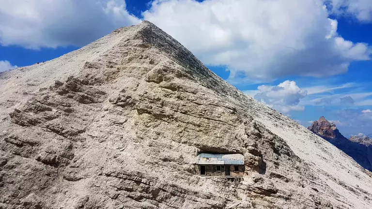
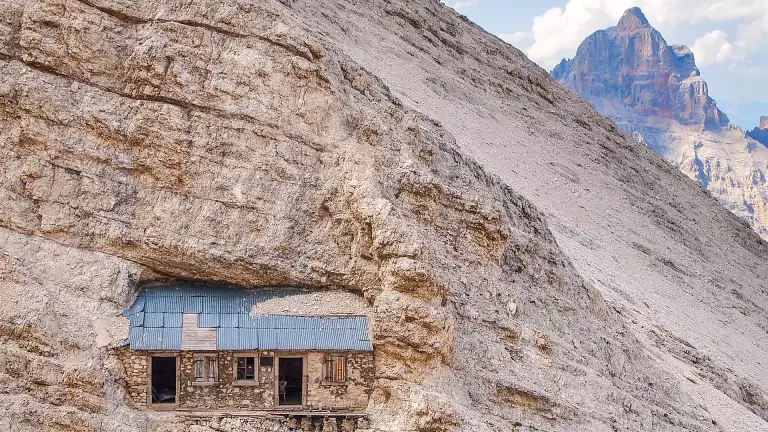
The Dibona route continues northwest along the crest. After crossing the Cresta Bianca, it reaches Forcella Padeon (2,760 m), where an emergency shelter stands inside what was once the command hut of Major Carlo Buffa, responsible for operations on this front. Beyond Forcella Padeon, the route passes Col Pistone and the Vecio del Forame—where some ledges are only partially equipped—before arriving at Forcella Alta (2,640 m). A steep scree gully then leads southwards to Forcella Bassa.
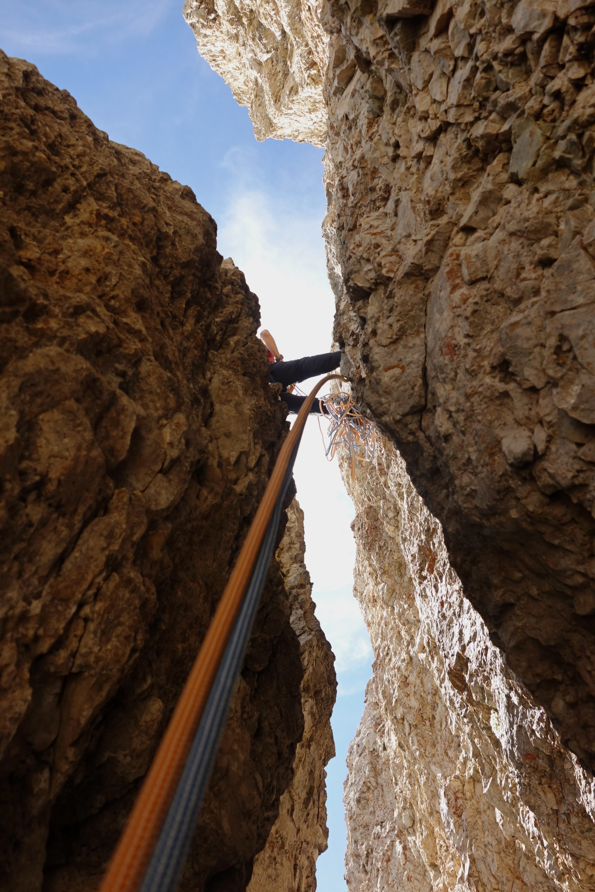
Turning northwest again, a more complex section climbs to the Zurlon ridge, where further wartime remains can be seen. Continuing along the crest, the route reaches Col dei Stombi (2,168 m), from which an old military mule track descends into Val Grande. From here, it is only a short distance to Ospitale, located along State Road 51.
Starting Point
Parking is available near the Rio Gere restaurant, where the chairlift to the Son Forca Hut departs. The lift facilities are reached by following the road to Passo Tre Croci, which connects Cortina d’Ampezzo with Auronzo di Cadore.
Via Ferrata Details
Maximum altitude: 2,985 m
Possible stops: Rifugio Lorenzi (2,932 m), at the upper station of the Rio Gere cableway/chairlift, near Forcella Staunies (2,918 m)
Elevation loss: approx. 1,500 m of descent from Forcella Staunies to Ospitale
Estimated time: about 8.5 hours (Forcella Staunies → Ospitale)