 © Associazione Turistica Val Passiria – Petr Blaha
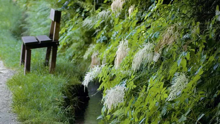
The Merano Water Trails, known as the Waalwege, stretch across the entire Merano area following the historic irrigation channels. The full route covers 80 km and can be completed in 7–8 days or as individual stages.
Stage 1: Töllgraben – Caines
Töllgraben – Jakobsweg trail – Lagundo irrigation channel – Ochsentod trail – Herrschaftsweg trail – Caines irrigation channel – Caines
Variants: – Wine & educational trail – Quarazze – Tappeiner Promenade – Merano – Castel Thurnstein – San Pietro – Tyrol Castle
Duration: 3:45 h Length: 11 km
Elevation gain: 640 m
Parking: before the Töllgraben bridge, along the Lagundo irrigation channel
Public transport: bus lines 213 Merano–Lagundo–Parcines, 235, 237, line 251 Silandro–Merano, and the Val Venosta railway
Arrival: from Merano towards Tel, to the parking area east of Tel
Stage 2: Caines – Saltusio
Hotel Ungerichthof – Rifiano irrigation channel – “Madonna of the Seven Sorrows” meditation trail – Rösslsteig trail – Saltusio village centre Variants: – Short descent connecting Rifiano with the Baroque sanctuary – From the Rösslsteig trail, a short ascent leads to the prehistoric settlement of Burgstall Duration: 2:15 h
Length: 7.6 km
Elevation gain: 260 m
Parking: at Hotel Ungerichthof
Public transport: bus line 240 Val Passiria–Merano from Merano to Caines
Arrival: from Merano towards Val Passiria, then turn left before Rifiano
Stage 3: Saltusio – Val di Nova
Saltusio – Maia irrigation channel – Waldweg trail – Wiesenweg trail – Scena irrigation channel Variants: – Continue to Merano/Maia Alta, with connections to the town centre (line 3), Scena (line 231), and the Taser cable car (line 233). At the last junction, follow route no. 10 to the Lazago trail and the city centre – Visit Scena Castle: below Castel Thurn, follow the Wiesenweg trail to Scena and the castle. Bus connections to the Taser cable car (line 233) and Merano (line 231)
Duration: 3:45 h
Length: 11 km
Elevation gain: 420 m
Parking: at the Hirzer cable car valley station
Public transport: bus line 240 Val Passiria–Merano Arrival: from Merano into Val Passiria to Saltusio
Stage 4: Val di Nova – Postal/Lana
Val di Nova car park – Montefranco – Via Graf Volkmar – Postal centre
Variant: Fragsburg Waterfall
Duration: 3:45 h
Length: 13 km
Elevation gain: 260 m
Parking: at the Merano 2000 cable car station
Public transport: bus line 232 Scena–Merano 2000–Trauttmansdorff
Arrival: from Merano into Val di Nova to the Merano 2000 cable car station
Stage 5: Lana – Tel
Parish church of Lana di Sotto – Brandis irrigation channel – Cermes irrigation channel – Marlengo irrigation channel – Tel
Variant: Brandis irrigation channel – Brandis stream – waterfall
Duration: 4 h
Length: 13 km
Elevation gain: 300 m
Parking: limited spaces in front of Hotel Krone, Via Schnatterpeck
Public transport: train or bus from Merano or Bolzano to Lana/Postal
Arrival: from Merano or Bolzano via the MEBO expressway, exit Lana
Stage 6: Tel – Rablà
Tel – Via Peter Mitterhofer – Parcines irrigation channel – Rablà irrigation channel
Variants: Parcines waterfall – “Sagenweg” (Legends Trail)
Duration: 2:15 h
Length: 6 km
Elevation gain: 280 m
Parking: near the fruit stalls and before the Tel bridge Public transport: bus from Merano to Tel; the stop is just before Tel at the start of the stage
Arrival: from Merano towards Tel to the parking area east of Tel
Stage 7: Rablà – Naturno
Rablà – Monte Sole panoramic trail – Wallburgweg trail – nature & educational path – Naturno centre Variant: San Procolo Chapel – Wallburgweg trail – Wallburgboden (15 min)
Duration: 2:30 h
Length: 9.6 km
Elevation gain: 400 m
Parking: along Via Lahn
Public transport: train or bus from Merano to Rablà Arrival: from Merano along the Val Venosta state road to Rablà
Stage 8: Naturno – Töllgraben
Naturno – meditation trail – Rittersteig trail – Via Peter Mitterhofer
Variant: from the Alpine-Well-Fit route near Plaus, cross the Gröbenweg trail to reach the village centre of Plaus
Duration: 3:30 h
Length: 11 km
Elevation gain: 290 m
Parking: Via Stazione, Naturno
Public transport: train or bus from Merano to Naturno Arrival: from Merano along the Val Venosta state road to Naturno