 © Luka Uher | Dreamstime
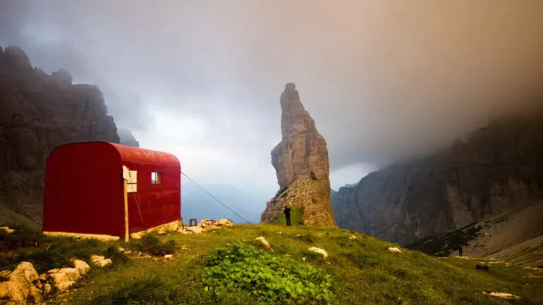
The Dolomites High Route no. 6, known as The Way of Silence for its long, solitary and untouched stretches, covers about 180 km divided into 11 stages, connecting Sappada with Vittorio Veneto. This spectacular itinerary crosses the provinces of Udine, Pordenone, Belluno and Treviso, traversing the mountain groups of Rinaldo, Tèrze and Clap, Monti di Sauris, Tiàrfin, Cridola, Spalti and Monfalconi, Duranno–Cima dei Preti, and Col Nudo–Cavallo.
With several sections around 2000 m, the route is recommended for experienced and well‑trained hikers, as some exposed stretches are equipped but demanding.
Technical data – High Route 6
Start: Sappada
Finish: Vittorio Veneto
Duration: 11 days
Total length: approx. 180 km
Mountain huts on the main route: 7
Bivouacs on the main route: 2 + one shelter at Col Nudo
Food stops along the route: approx. 10
Longest stage: Casera Laghét de sora → Bivacco Greselin (Stage VII) – 8 hours
Shortest stage: Rifugio Giaf → Rifugio Padova (Stage V) – 3 hours
Total hiking time: approx. 65 hours
Difficulty: E – EE (some sections EEA)
Total ascent: approx. 9000 m
Total descent: approx. 10,000 m
Highest point: Forcella Campol – 2450 m
Lowest point: Vittorio Veneto – 139 m
Dolomite groups crossed: 8
Hut opening period: late June – late September
Recommended season: late June – late September
Signage: generally good; extra attention required in the Duranno–Cima dei Preti and Col Nudo areas
Recommended maps
Tabacco 1:25,000 series
- No. 01 – Sappada – S. Stefano – Forni Avoltri
- No. 02 – Forni di Sopra – Ampezzo – Sauris – Val Tagliamento
- No. 021 – Dolomiti di Sinistra Piave
- No. 012 – Alpago – Cansiglio – Piancavallo – Val Cellina
- No. 024 – Prealpi e Dolomiti Bellunesi
Stages of High Route 6
Stage I – Rifugio Sorgenti del Piave → Sappada via the Olbe Lakes
Hiking time: 4 hours Paths: 136, 129, 135
Stage II – Sappada → Rifugio Fratelli De Gasperi via Passo Èlbel
Hiking time: 4 hours Paths: 314, 315, 201 Variant: via Passo Oberenghe
Stage III – Rifugio De Gasperi → Rifugio “Tenente Giuseppe Fabbro” via Forcella Lavardêt
Hiking time: 4 hours Paths: 201, 203 + short stretch on State Road 465
Stage IV – Rifugio Fabbro → Rifugio Giaf via Doàna
Hiking time: 6 h 30 min Paths: State Road 619, 338, 336, 207, 341
Stage V – Rifugio Giaf → Rifugio Padova
Hiking time: 3 hours Path: 346
Stage VI – Rifugio Padova → Casera Laghét de sora via Forcella Spe
Hiking time: 4 h 30 min Paths: 352, 389, 390 Variants:
via Val Meluzzo, Rifugio Pordenone, Sentiero Marini, Bivacco Gervasutti
via Bivacco Granzotto‑Marchi and Bivacco Perugini
via Rifugio Padova, Rifugio Tita Barba, Casera del Cavalet, Forcella del Frate
via Forcella Segnata, Rifugio Padova, Rifugio Tita Barba
Stage VII – Casera Laghét de sora → Bivacco Greselin
Hiking time: 8 hours Path: marked but unnumbered
Stage VIII – Bivacco Greselin → Rifugio Maniago → Erto → Cimolàis
Hiking time: 8 hours Paths: 358, 374 + short stretch on State Road 251 Variant: Osvaldo Zandonella alpine route
Stage IX – Cimolàis → Ricovero Col Nudo
Hiking time: 5 hours Path: 965 Variant: via Bivacco Frisacco
Stage X – Ricovero Col Nudo → Rifugio Semenza
Hiking time: 6 h 30 min Paths: 965, 924
Stage XI – Rifugio Semenza → Vittorio Veneto
Hiking time: 9 hours Paths: 923, 922 + short stretch on State Road 422
Important notes
Before starting the route, hikers should always:
- check weather conditions,
- verify hut openings and availability,
- ensure adequate equipment for exposed and high‑altitude terrain.