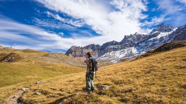
This circular hike leads into the heart of Rocca Pietore, following a route that alternates between old military roads, quiet alpine pastures and spectacular views of the Marmolada. It’s a medium‑difficulty itinerary, ideal for those who enjoy walking through history and the grand landscapes of the Dolomites.
From Rifugio Migon to the Femaze pastures
After driving up to the Laste area and the village of Davare, you reach Rifugio Migon (1537 m), the starting point of the hike. From here, a comfortable forest road climbs gently towards the Femaze pastures, where small mountain huts recall the traditional high‑altitude haymaking of the past.
Towards Malga Laste and the traces of the Great War
The ascent continues to Malga di Laste (1868 m), an area where the remains of Italian heavy artillery positions from the First World War are still visible. It’s a stretch rich in historical charm, framed by wide meadows and Dolomite ridges.
Col de la Casiera: spring water and views of the Marmolada
Following the old military road, you reach the ridge of Col de la Casiera (1891 m), where a fresh mountain spring offers a welcome break. From here, the Marmolada dominates the horizon, rising above the green crests of the Padon.
Roschei, Val Rosa and the Tie huts
The road descends gently to the Roschei huts, then climbs again along Val Rosa to the old Tie huts, now in ruins but surrounded by bright alpine pastures and deep silence, broken only by the whistle of marmots.
Final ascent to the Crepe Rosse and descent to Capanna Bill
The last stretch leads to the ridge of the Crepe Rosse, where the trail—though not always clearly marked—remains intuitive and easy to follow. Once at Passo Crepe Rosse (2137 m), the highest point of the route, the path descends on the opposite side to Capanna Bill (1780 m), near the state road 641 leading to Passo Fedaia.