 © Mario Vidor
The Adige–Garda cycle path connects Vallagarina with Lake Garda and links directly to the Adige Valley cycle route. It is an easy itinerary with only a few short climbs, such as the ascent toward Passo San Giovanni, and can be ridden from March to September.
The total length of the Adige–Garda cycle path is about 20 km, divided into two sections: from Mori to Torbole and from Torbole to Riva del Garda. The starting point is in Mori, south of Rovereto, just after the ENEL barrier. The route begins on mixed-traffic roads before joining the cycle path that runs alongside the Cameras stream. Shortly afterwards you reach Nago, where the cycle path ends, passing through the Loppio Lake biotope. From here, the route climbs to the top of the retaining wall south of Nago and then descends toward Torbole along an old road with limited traffic.
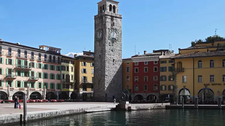
From Torbole, the second spectacular section begins: a lakeside cycle path with a cantilevered walkway over the water, running along the beaches all the way to Riva del Garda. Those who wish can continue along the route that follows the Varone stream up to the impressive Varone waterfall, which can be visited on foot, or head directly into the center of Riva.
Start: Mori Finish: Riva del Garda
Surface: asphalt
Maximum gradient: 15%
Route type: cycle path and country roads
Traffic: mixed