 © Shutterstock
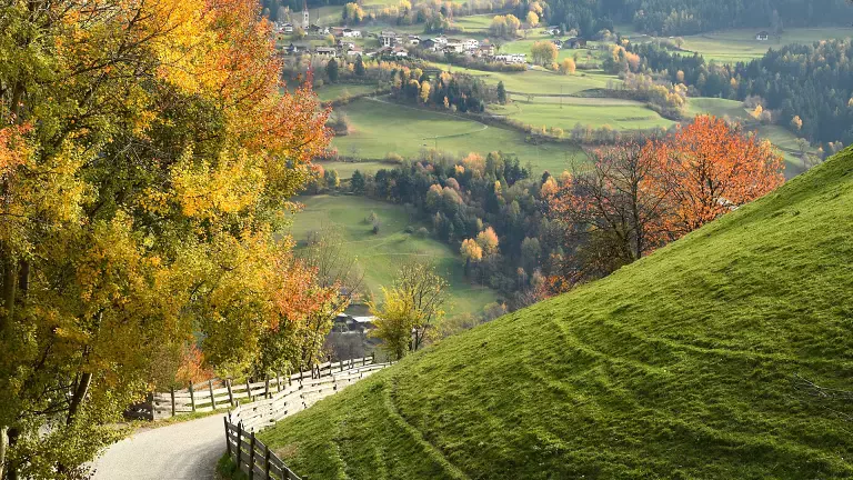
The Chestnut Trail (Keschtnweg in German) is a wonderful 90 km long route through the chestnut woods of the Isarco Valley, from the Abbey of Novacella in Bressanone to Roncolo Castle in Bolzano. Beautiful in every season, it is particularly fascinating in autumn when the leaves and meadows change colour. The trail can be divided into four stages, all of which are well signposted, leading through ancient chestnut groves and colourful broadleaf trees along ancient paved roads, where here and there are small farmsteads where you can stop to taste and buy typical regional products and, why not, spend the night to leave the next day for the next stage or return to the starting point.
The Chestnut Path, which is particularly popular during the Törggelen period, is also easily accessible by public transport to the various starting points of the itinerary.
The stages of the Chestnut Trail
1st stage: from Novacella to Feldthurns/Velturno
Route length: 17 km
Metres in altitude ascent: 660 m
Height difference descent: 388 m
Average walking time: 5:30 h
The start of the first stage is near the car park of the Novacella Abbey, where you will find one of the best wine cellars in the Isarco Valley. This route is 16 km long and along the way you can admire three characteristic little churches. From the Abbey you first reach Varna, then continue through the woods following the Spelcona stream and, still following the signposts, after about 5 hours you reach Velturno.
2nd stage: from Feldthurns to Klausen
Route length: 5.8 km
Metres in height ascent: 95 m
Metres in height descent: 428 m
Average walking time: 1:55 h
After visiting Velthurns Castle in Feldthurns, walk through the village centre in a southerly direction. Cross the village passing Laurentius Church and walk straight
on until you reach the Antonius Chapel and the large chestnut tree (natural monument) on the left side street. Continue towards Pedratz. After about 200 m, cross a bridge and turn right up to the Radoar farm (refreshment stop)
3rd stage: from Klausen to Barbian
Route length: 10.8 km
Metres in altitude ascent: 621 m
Metres in altitude descent: 298 m
Average walking time: 3:55 h
From the historic centre of Klausen with its winding alleys, inviting shops and cosy inns, the Chestnut Trail runs in a south-westerly direction. Between Thinne Square and the Capuchin Monastery, the Thinne Bridge crosses the Thinne stream, which, together with the Eisack River, has repeatedly struck fear into the little town through flooding. The path leads over the old Latzfons road into the Thinne Valley and branches off to the left after a narrow tunnel. Slowly hike uphill over the steep farm access road until you reach the Muttner Hof farm (664 m). After the farmstead, turn left uphill and follow the trail leading up into the forest at the upper edge of the orchards. Pass the old, abandoned farmstead of the Staudach Höfl farm and continue to the meadows of the Johannser Hof farm (754 m, refreshment stop approx. 200 m to the left of the Keschtnweg).
4th stage: from Barbian to Bolzano
Route length: 33.9 km
Metres in altitude ascent: 934 m
Metres of descent: 1,498 m
Average walking time: 11:15 h
From the village centre of Barbian, the Chestnut Trail follows the asphalt road for a bit in the direction of Saubach. After about 10 minutes, you reach the new 120 m long bridge that crosses the deeply cut valley of the Ganderbachgraben.
From the bridge you experience a magnificent view of the waterfall and the walls of the Saubach Kofel. On the orographic right bank of the Gonderbach, follow the asphalted road to the beautifully situated hamlet of Saubach (800 m, Saubacher Hof inn). Continuing along the road, we come to the farms Bischof and Penn, branching off to the left there, the route leads along a field path below the road (the signposted access from Kollmann leads up here). Shortly before the Diktelegraben, the path re-joins the road. After the bridge, directly on the municipal border to Ritten, you reach a shady rocky area and hike along the road until you reach the Rotwand farms.
How to get to the Chestnut Path
If you want to walk the whole route, you can reach the Abbey of Novacella:
- By car: A22 Brennero motorway, Chiusa-Val Gardena exit and follow the signs for Varna (SS242d)
- By train: Bressanone arrival station, where all Eurocity and Intercity trains on the Verona - Brenner route stop. From the station there are connections to the surrounding areas.
- By plane: Verona Villafranca (190 km) and Innsbruck (85 km) Bergamo, Verona, Venice and Treviso are connected to South Tyrol by shuttle bus.