The hike starting from Rifugio Passo Sella (2183 m) is one of the most scenic routes in the Sassolungo Group. Trail 525 climbs toward the Forcella del Sassolungo, crossing meadows dotted with boulders and skirting the impressive fossil landslide known as the Città dei Sassi. The ascent becomes steeper on the scree slope leading to the saddle, beneath the cable car which—if operating—saves more than an hour of walking.
A demanding stretch leads to Rifugio Toni Demetz (2681 m), set between the Cinque Dita and the Sassolungo. From here, the path descends northwards through a rocky gully to Rifugio Vicenza (2253 m), the starting point for the via ferrata.
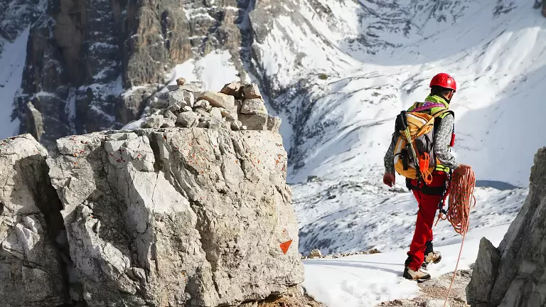
Following the signs for the Oskar Schuster Route, the trail enters the basin below the Sassopiatto until the base of the gully where the ferrata begins. The route climbs through small chimneys, rocky steps and ledges equipped with cables, reaching the Forcella delle Torri (2730 m). From here, ramps and scree lead to the summit ridge and finally to the Cima di Mezzo of the Sassopiatto (2954 m), offering a 360° panorama over the Dolomites.
The descent follows the opposite slope over slabs and scree to Rifugio Sassopiatto (2300 m). The return to Passo Sella continues along the panoramic Friedrich‑August Trail (4–594), passing the Pertini and Federico Augusto huts, then Forcella Rodella and Bar Salei.
Technical details
- Start/End: Rifugio Passo Sella – 2183 m
- Highest point: Cima di Mezzo, Sassopiatto – 2954 m
- Elevation gain: 1200 m (700 m with cable car)
- Duration: 7 hours (5h45 with cable car)
- Difficulty: Experienced hikers + via ferrata equipment
- Season: July to September
- Huts along the route: Toni Demetz, Vicenza, Sassopiatto, Pertini, Federico Augusto