 © Società Cooperativa Turistica Chiusa, Barbiano, Velturno e Villandro
How to reach the starting point: From the village of Villandro, drive along the road leading to the Alpe di Villandro. After about twenty minutes by car, you will arrive at the Saltnerstein parking area near the Gasser Hut (Malga Gasser), at an altitude of 1744 metres.
From here the hike begins on foot: follow trail 6/15, which climbs westwards and is well signposted, until you reach the Mair in Plun inn at 1860 metres. Continuing along the alpine road marked with number 6, you arrive at the Köber Leger hut, located at 2080 metres.
The route continues on trail number 1 heading north, crossing marshy meadows. At the first junction, turn left onto trail 16, which leads to the Prackfieder Jöchl saddle at 2088 metres. From here, with a gentle descent on the western slope, you reach the Moar in Ums hut at 2055 metres.
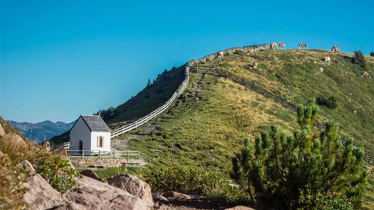
Following trail 16B, you arrive at the Seebergalm hut at 2094 metres. From there, trail number 6 climbs up to the small Totenkirchl chapel at 2186 metres. Continuing to the right along the “T” waymark, you reach the Totensee lake at 2210 metres and then proceed to the eastern ridge of Mount Villandro, which rises to 2356 metres.
The descent follows the same ridge down to a large wayside shrine at 2150 metres. From here, descend to the right along trail number 1 until you reach the Sella dei Sentieri at 2058 metres. The descent continues along trail number 7, which cuts across the bends of the alpine road, until you reach the Kaser hut at 1742 metres.
From there, following the road, you finally return to the Saltnerstein parking area, the starting point of the hike.