 © Società Cooperativa Turistica Naturno
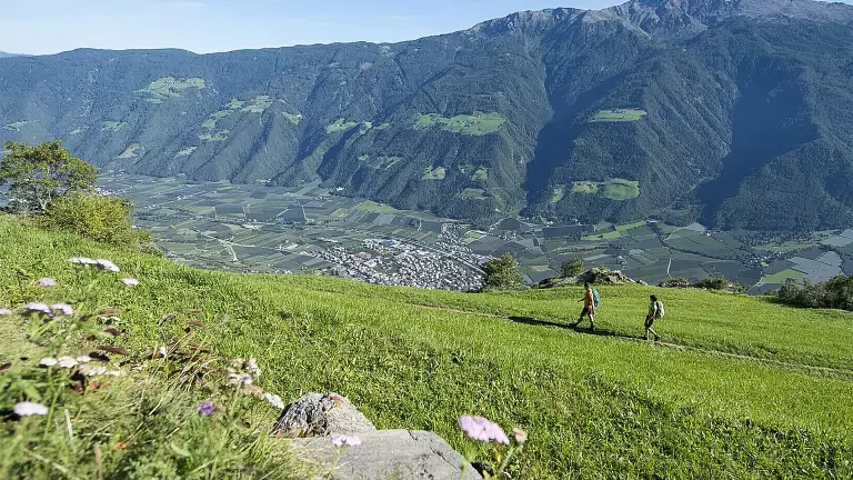
The farmstead hike on Monte Volpe begins with the Unterstell cable car from Naturno up to the mountain station at 1,300 meters.
From there, the route follows trail no. 10a leading to the Patleid farm, where it turns left towards Monte Santa Caterina.
Halfway along, trail no. 24a joins the Merano High Mountain Trail no. 24, between the Linthof restaurant and the Innerunterstell farm. This section crosses the dry grassland biotopes of Monte Sole, characterized by a rich presence of butterflies and Mediterranean vegetation unusual for the alpine environment.
Continuing along the High Mountain Trail, the route reaches the Kopfron farm at 1,436 meters, a panoramic point offering wide views over Val Venosta, Castel Juvale, and Val Senales. From here, the High Mountain Trail is left and trail no. 23 leads to the Dickhof farm, one of the oldest in the area, before descending towards the Linthof farm through meadows and larch forests. The final descent follows trail no. 10, returning to the mountain station of the Unterstell cable car and closing the circular hike.
The itinerary is of medium difficulty and is notable for its landscape variety, alternating alpine and Mediterranean environments, and for the presence of historic farms that enrich the experience with glimpses of traditional rural life.
Arrival description: Naturno/Compaccio – Via Bersaglio – valley station of the Unterstell cable car
Parking: directly at the Unterstell cable car parking area
Public transport:
- Bus 251 – Naturno/Merano – stop Compaccio/Unterstell
- Bus 261 – Naturno/Val Senales – stop Compaccio/Unterstell
- Bus 266 – Naturno/Unterstell – Rablà/Texel – stop Compaccio/Unterstell