 © Depositphotos
 © Mario Vidor
 © Angela Pierdonà
 © Angela Pierdonà
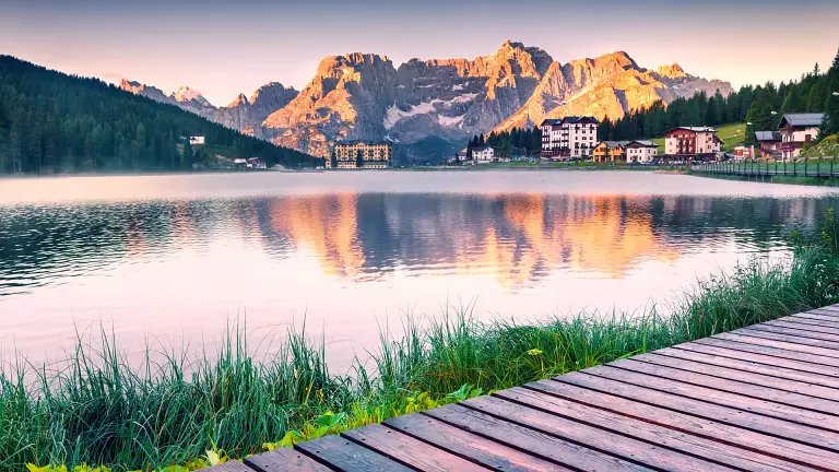
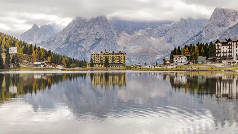
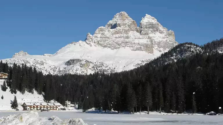
Lake Misurina is the largest natural lake in Cadore, situated at 1,754 meters above sea level, in the municipality of Auronzo di Cadore (Belluno), along the Dolomites State Road 48 bis, just 12 km from Cortina d’Ampezzo. The water mirror lies on the homonymous saddle, a natural watershed between the Adige and Piave basins.
Its position makes it one of the most scenic viewpoints in the Dolomites: from here you can admire some of the most iconic peaks of the UNESCO-listed Dolomites, such as the Three Peaks of Lavaredo, the Cristallo Group, the Cadini di Misurina and the Sorapiss.
The name “Misurina” probably derives from the Ladin term “meso ai rin”, meaning “in the middle of the streams”, clearly referencing the abundant water presence and the hydrogeological features of the area.
Things to do at Lake Misurina
The lake is a perfect tourist destination in any season, ideal for those who love nature, tranquility and mountain hiking.
Nearby hikes from Lake Misurina:
- Loop around Lake Misurina: scenic and easy-level walk around the lake, suitable for families and children.
- From Lake Misurina to Col de Varda and Rifugio Città di Carpi: hiking route starting near the ski lifts or chairlift (open in summer).
- Val Popèna Alta: trail for experienced hikers, with spectacular views of the surrounding peaks.
- Rifugio Fonda Savio and Forcella del Diavolo: more challenging hike through the Cadini and rocky valleys.
- Sentiero Bonacossa: partially equipped high-altitude traverse, recommended for skilled hikers.
Lake Antorno and access to the Three Peaks
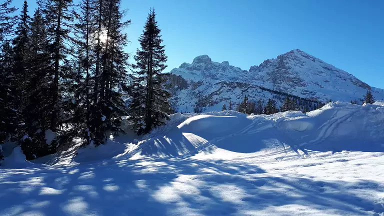
Just above Misurina is Lake Antorno, a small yet evocative water mirror, which serves as an important starting point to reach the Three Peaks of Lavaredo. In summer it is possible to continue by car (toll required) up to Rifugio Auronzo, while in winter the route is accessible by snowmobiles or snowshoes, making it one of the most spectacular winter experiences in the Dolomites.
Frequently Asked Questions about Lake Misurina
Where is Lake Misurina located?
In the municipality of Auronzo di Cadore, Belluno, Veneto.
How do you get to Lake Misurina?
By car via the SS48 bis, or via seasonal bus services from Cortina or Auronzo.
What is the best time to visit?
Spring, summer, and early autumn for hiking; winter for snowy landscapes, snowshoe walks, and snowmobile excursions.
Is it suitable for families?
Yes, the walk around the lake is easy and suitable for everyone. Accommodations, restaurants, and services are available nearby.
Are there facilities for hikers?
Yes, there are alpine huts and ski lift access like the one at Col de Varda.