 © Tourist Office San Vigilio/San Martin - Dolomites
 © Tourist Office San Vigilio/San Martin - Dolomites
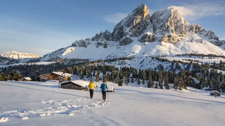
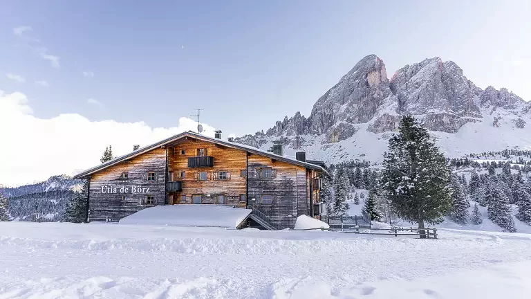
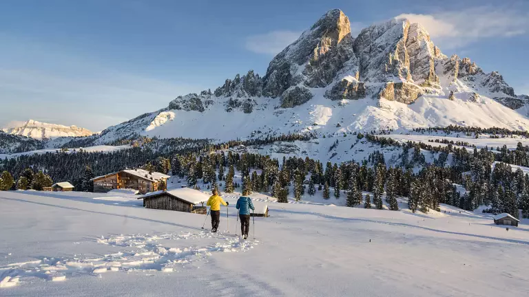
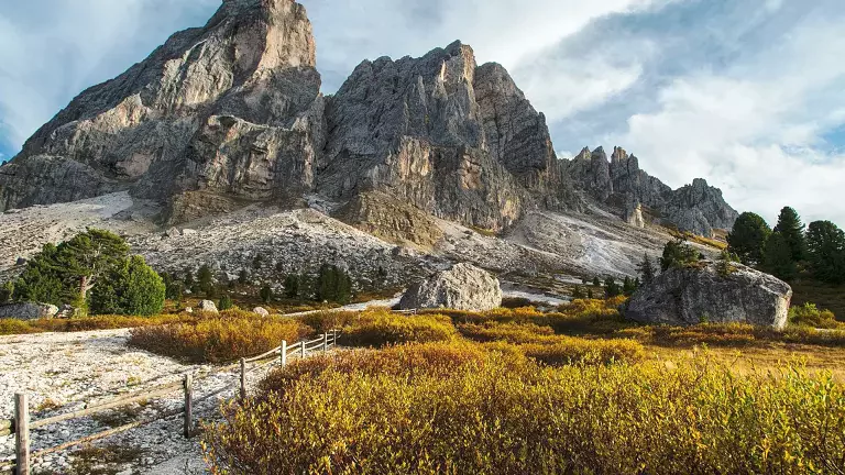
Sass de Putia, also known as Sasso delle Putia, Sasso Putia or Peitlerkofel in German, is one of the most distinctive mountains of the Dolomites UNESCO World Heritage Site. Rising to 2,875 metres, it is located in the north-western part of the Dolomites, within the Puez-Odle Nature Park in South Tyrol.
Its imposing summit dominates the landscape south of Passo delle Erbe, the mountain pass connecting the Val di Funes area with Val Badia. The pass lies at around 2,000 metres above sea level and is one of the best-known starting points for hikes around and to the summit of Sass de Putia.
The mountain is also located in an area of particular cultural and linguistic interest, between Ladin- and German-speaking territories. Thanks to its position and distinctive shape, Sass de Putia is one of the most fascinating panoramic viewpoints in the north-western Dolomites.
Sass de Putia: Features and Interesting Facts
Sass de Putia has a geological structure linked to the Funes Line, an important tectonic line running through this part of the Dolomites. The massif includes the main summit of Sass de Putia, at 2,875 metres, and the nearby Piccolo Putia.
The Forcella del Putia, located at around 2,357 metres, is one of the main points along the hiking route and provides access to the mountain's slopes via a network of alpine trails.
The area is also connected with the history of mountaineering in South Tyrol. The northern face of Sass de Putia was once used as a training ground by Reinhold Messner, one of the most famous mountaineers in history.
Panoramic Views from the Summit of Sass de Putia
One of the main reasons to hike to the summit of Sass de Putia is the spectacular 360-degree panorama.
The mountain's isolated position provides an exceptionally wide view across the surrounding Alps. On clear days, looking north, you can identify some of the major peaks of the Eastern Alps, while looking south the panorama opens towards many of the great Dolomite groups.
Among the most important mountain ranges visible from the Sass de Putia area are the Puez-Odle group, the Sella group and Marmolada, as well as other major mountains of South Tyrol and the Dolomites.
The summit is therefore an exceptional viewpoint for admiring the unique geological and natural landscape of the Dolomites, with views extending from the mountains of South Tyrol to the great Dolomite massifs.
Hiking to Sass de Putia: How to Get There
The classic route to Sass de Putia starts at Passo delle Erbe, at around 2,000 metres above sea level. The pass can be reached by car and is a popular starting point for several hikes in the Puez-Odle Nature Park.
From the car park, follow trail 8A, which crosses alpine meadows and leads towards the Munt de Fornella area, at around 2,080 metres above sea level. From here, the route continues towards Forcella del Putia, following the marked hiking trail.
The final section towards the summit is the most demanding part of the hike. It includes steeper terrain and some sections equipped with fixed ropes, requiring sure footing and confidence in a mountain environment.
This final section should not be underestimated, particularly in wet conditions, with residual ice or when the weather is changeable. Before setting off, always check the current trail conditions and the weather forecast.
Once you reach the summit, the panoramic views over the Dolomites are a well-deserved reward for the climb.
Sass de Putia: Circular Route or Return Along the Same Trail
From the summit, you can return along the ascent route or choose a circular variation, depending on trail conditions and the route selected.
One option is to continue towards the Prati di Putia and follow the trails around the massif, passing several alpine huts and panoramic viewpoints before returning towards Passo delle Erbe.
The circular route allows you to see Sass de Putia from different perspectives and is particularly suitable for those who want to enjoy a more complete hike through the landscape of the Puez-Odle Nature Park.
One circular route published on Outdooractive, starting from Passo delle Erbe and going around Sass de Putia, indicates a total hiking time of approximately 5 hours and 30 minutes.
How Long Does the Sass de Putia Hike Take?
For the complete route from Passo delle Erbe to the summit of Sass de Putia and back, the figures may vary depending on the route selected.
A hiking route published on Outdooractive indicates approximately 10.9 km, 5 hours and 45 minutes of hiking time and 980 metres of positive elevation gain for the normal route to Peitlerkofel.
For this reason, the following figures are suitable as a general reference:
- Duration: approximately 5–6 hours
- Distance: approximately 11 km
- Elevation gain: approximately 980 m
- Difficulty: moderate, with a more demanding final section and equipped passages
- Maximum altitude: 2,875 m
Actual hiking times depend on individual pace, trail conditions, breaks and the route chosen.
Useful Information for Hiking to Sass de Putia
- Starting point: Passo delle Erbe, approximately 2,000 m
- Summit elevation: 2,875 m
- Forcella del Putia: approximately 2,357 m
- Distance: approximately 11 km for the reference full route
- Duration: approximately 5–6 hours
- Elevation gain: approximately 980 m
- Difficulty: moderate, with a more demanding final section and equipped passages
- Recommended season: generally from late spring to autumn, always checking trail conditions and the possibility of snow
- Equipment: hiking boots or suitable mountain footwear, technical layered clothing, water and protection from rain and sun
- Recommended: a helmet for those who consider it appropriate on more exposed sections, as well as equipment suitable for current mountain conditions
Sass de Putia is a mountain hike requiring good physical fitness, especially because of the overall elevation gain. The equipped section towards the summit also requires care and secure movement. Conditions at high altitude can change rapidly, and snow or ice can make the route significantly more difficult.
FAQ: Sass de Putia
Where is Sass de Putia located?
Sass de Putia is located in the Dolomites of South Tyrol, in the north-western part of the Dolomites UNESCO World Heritage Site, within the Puez-Odle Nature Park.
Where does the Sass de Putia hike start?
The most common starting point is Passo delle Erbe, located at around 2,000 metres above sea level. From here, the trail leads towards Munt de Fornella and Forcella del Putia.
How long is the Sass de Putia hike?
For the complete reference route from Passo delle Erbe to the summit and back, the distance is approximately 10.9 km, although the total distance may vary depending on the route and any circular variations.
How long does it take to hike Sass de Putia?
The complete route generally takes around 5–6 hours. One reference route indicates 5 hours and 45 minutes for approximately 10.9 km and 980 metres of positive elevation gain.
Is the Sass de Putia hike difficult?
The hike requires good physical fitness because of the elevation gain. The final section towards the summit is more demanding and includes passages equipped with fixed ropes. Although it is not necessarily a mountaineering route, it should be undertaken with sure footing and adequate hiking experience.
What is the best time of year to hike Sass de Putia?
The best period is generally summer and autumn, although accessibility depends on mountain conditions. Before setting off, check the weather forecast and whether snow or ice is present along the route.
What can you see from the summit of Sass de Putia?
The summit offers wide panoramic views over the Dolomites and the Eastern Alps. Among the major Dolomite groups visible from the area are the Puez-Odle, the Sella group and Marmolada.