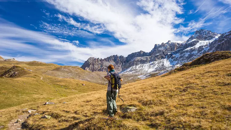
An excursion at the foot of the Presanella, the highest peak in Trentino, immersed in a high‑altitude environment where hiking meets the history of mountaineering.
Itinerary A – From Passo Tonale to Rifugio Denza
A two‑day route starting from Passo Tonale (1880 m) and leading into the wild heart of Val Stavèl, among historic fortifications, high‑mountain pastures and spectacular views of the Presanella.
First stage
Before reaching the pass, coming from Vermiglio, turn near the Casa Cantoniera and continue for about 3 km along a dirt road. From here, follow SAT trail 268, which crosses the Rio Presena and climbs towards Forte Pozzi, reached in about two hours. From the fort, continue along trail 233, which rises through the valley to Rifugio Francesco Denza, the ideal base for exploring the high‑altitude environment.
Second stage
From the hut, follow trail 234 to Passo dei Pozzi, reached in about one hour. The descent follows a steep gully with loose soil, moraine debris and grassy patches, leading to the Pozzi pastures and then to Pozzi Bassi. From here, rejoin trail 268, which returns to Passo Tonale, completing a loop of great scenic interest.
Technical data
Start/finish: Passo Tonale – 1880 m
Elevation gain/loss: +986 m / –990 m
Duration: 2 days
Total distance: 12–13 km
Effective walking time: 5.5 – 6.5 hours
Itinerary B – From Vermiglio to Rifugio Denza and return to Velon
An equally fascinating alternative that starts from the valley floor and allows you to experience the full ascent to the hut through forests, clearings and glacial landscapes.
First stage
From Vermiglio – Stavel (1218 m), follow SAT trail 206, which climbs steadily through woods and grassy slopes until reaching Rifugio Denza, where you spend the night.
Second stage
The next day, climb again to Passo dei Pozzi along trail 234. Then descend towards Pozzi Bassi, in the Carbonere area, where you meet the connection with trail 268. The descent continues along the forest road to Baita Velon (1390 m), the endpoint of the itinerary.
Technical data
Start: Vermiglio – Stavel 1218 m
Finish: Vermiglio – Velon 1390 m
Elevation gain/loss: +1370 m / –1244 m
Duration: 2 days
Total distance: 14–15 km
Effective walking time: 6.5 – 7.5 hours
Why choose this trek
This itinerary is ideal for those seeking an authentic high‑mountain experience, surrounded by glacial scenery, traces of the Great War and the welcoming atmosphere of Rifugio Francesco Denza. The view of the Presanella (3558 m) accompanies every step, offering a trek that blends nature, history and adventure.