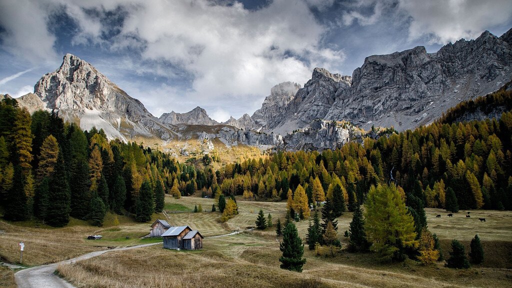
The Via Alpina: a network of 5 walking trails across the eight countries of the Alpine region, more than 5000km long and with 340 day stages. Four are the stages that cross the Trentino, specifically the Val di Fassa, in the presence of the majestic dolomitic massifs of the Sella, the Marmolada and the Catinaccio. The stages described below affect the Trieste-Munich direction, but it is also possible to follow them in the opposite direction.
The stages
Stage B22: Pordoi Pass – Contrin Hut
From the Pordoi Pass, take the path n 601 / Alpine path of the Dolomites n. 2 towards the Fredarola Hut. From here, following the "Viel dal Pan" path, continue to Viel dal Pan Hut. With the Marmolada in front, proceed to the connecting path that leads to "Porta Vescovo", where you turn right to reach the Fedaia Lake and later the Castiglioni Hut (trail 601). From here continue on path n. 605 to Col Ciampiè Hut and Hotel Viletta Maria. You follow a short stretch of asphalt road and then turn left, descending along a wide gravel path that crosses woods and pastures and sometimes the highway. You then reach the path marked with trail sign 602A, which goes up to Val Contrin and Contrin Hut.
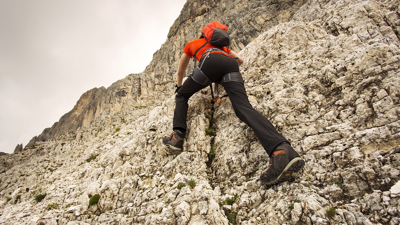
Alternative route: from the Marmolada “E. Castiglioni” refuge follow the dam until you reach the Cima Undici refuge. In front of it you can access path No. 606 that leads to the Pian dei Fiacconi refuge (or you can reach it by cable-way). From there, turning westward in the direction of Gran Vernel, continue on path no 606 which takes you to the valley that climbs up towards Forcella Marmolada. Once you have ascended to the saddle along a tongue of snow and ice, descend the southern slope, which is equipped with a metal safety cord for a short distance, then walk along the scree until you bend westward again and reach the Contrin Hut.
Length: 17 km
Time: 7 hours
Uphill altitude: 720 m
Downhill altitude: 930 m
Difficulty: medium
What to see: Great World War Museum, La Sia (ancient Venetian sawmill in Penia)
Stage B23: Contrin Hut – Fontanazzo
The path with the trail 648 goes up from the Contrin Hut to the San Nicolò Pass and the homonymous shelter. From here, take path n. 613 northwest, on the Varos rocks and then downhill to a grassy saddle. Following the eastern rocky wall of the "Croda Neigra", descend along the Forcagna Neigra up to the Ciampac valley basin and the Tobià del Giagher Hut. Climb then along the opposite side (path n 645) to Pian de Siele and Val de Crepa. After passing some huts, you reach the small village of Fontanazzo, a hamlet of the tourist town of Mazzin.
Alternative route: from the saddle, at the crossroads for the Croda Neigra, continue straight ahead in the direction indicated by signpost 613b. Follow the southern slope of the Sas de Rocia along the equipped path Lino Pederiva, until you once again join path No. 613 at Sella Brunech. From there, continue northwards along the grassy ridge on an unsignalled path that leads towards Crepa Neigra until you reach Pian de Siele.
Length: 14 km
Time: 6 hours
Uphill altitude: 740 m
Downhill altitude: 1360 m
Difficulty: medium
What to see: Molin de Pèzol (ancient watermill of Pera di Fassa), Ladin museum of Fassa, Mineralogic Monzoni Museum, the Pieve of S. Giovanni church, Campitello di Fassa
Stage B24: Fontanazzo – Antermoia Hut
From Fontanazzo we proceed along the mule track, marked with the sign n. 577, on sometimes very steep sections, towards the entrance of the Val di Dona. After passing some huts, the trail enters the route n. 580, which goes from Mazzin up through the Val Udai, along the Camerloi meadows to the head of the valley and beyond, to the Dona Pass. In 20 minutes you reach the Antermoia Hut.
Length: 9 km
Time: 4 hours
Uphill altitude: 1150 m
Downhill altitude: 40 m
Difficulty: medium
What to see: Antermoia lake
Stage B25: Antermoia Hut – Bolzano Hut
Along the path n. 584 you get to the Lake of Antermoia. Following the left bank, the route climbs quickly to the Antermoia Pass. We then proceed through the scree at the foot of the Catinaccio d'Antermoia reaching the Principe Pass and the homonymous shelter. Here, at the end of Val di Vajolet, cross the border between the provinces of Trento and Bolzano, and descend into the Busa del Principe and from there continue along a narrow gorge, climbing up to Molignon pass. Along a path that is sometimes secured with a wire rope, you will soon reach the Alpe di Tires mountain hut, then you will reach the wide plateau of the Sciliar massif along path n 3 in the northeast direction. After about an hour and a half walk you reach the Bolzano hut (2.450 m).
Alternative route: even if used prevailingly in the opposite direction, it is possible to ascend to the peak of Catinaccio di Antermoia along the eastern via ferrata and then descend along its western section (signpost 585). The via ferrata branches off just before reaching the Antermoia pass and climbs up towards the peak, exploiting the rock face’s numerous narrow ledges and canals. To reach the peak you need to follow the rather exposed ridge northwards. Then, to get down, you must take the same ridge southwards and then, along the other ledges and canals of the southern slope, descend towards the Principe pass.
Length: 11 km
Time: 5 hours
Uphill altitude: 820 m
Downhill altitude: 860 m
Difficulty: difficult
N.B. Before starting the itinerary, it is advisable to find out about the weather and verify the opening of the shelters and their availability.