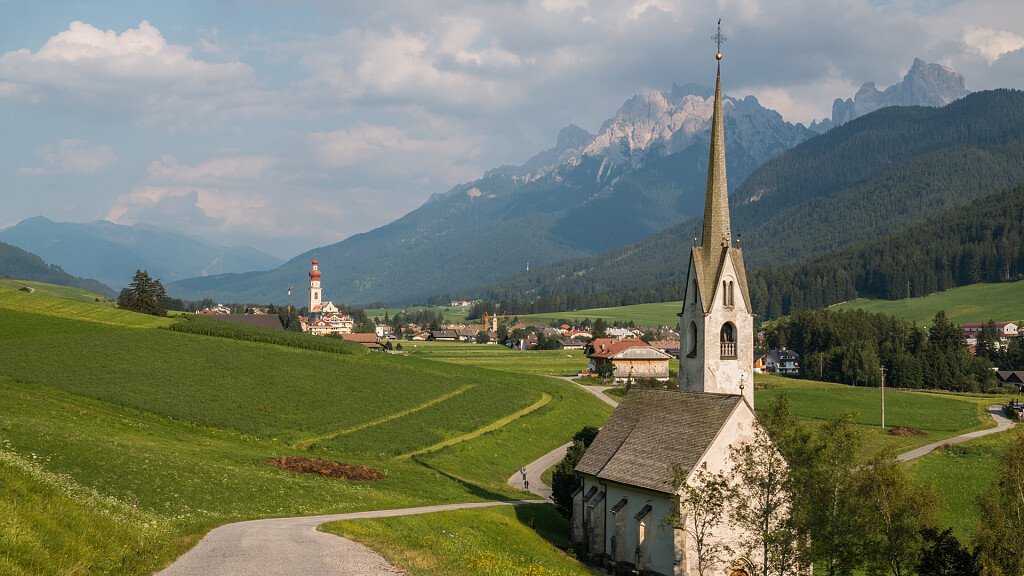
The Alpine Path of the Dolomites no.3, also called the "via dei camosci", as the paths follow the traces of these animals, has its starting point the town of Villabassa (near Dobbiaco) and point of arrival the country of Longarone, whose notoriety is sadly linked to the tragedy of the Vajont dam.
Developed in 8 stages and about 100 km long, the hiking route is suitable for more experienced hikers, with well-equipped stretches in the most dangerous points. For more experienced hikers it is possible to follow some alternative routes with respect to the classic route, especially in the first part of the Alpine Path of the Dolomites. It is also possible to start trekking starting from Misurina.
Along the crossing you can admire wonderful landscapes and discover famous dolomitic groups, such as the Tre Cime di Lavaredo, the Cristallo and Monte Pelmo, the mountain massifs of Monte Piana, scene of fierce fighting between Italians and Austrians during the First World War world, Sorapìss, Monte Rite and Bosconero.
Technical data
Path: Villabassa-Niederdorf (BZ) - Longarone (BL)
Crossing time: 8 days
Trail Length: about 100 km
Shelters on the main route: 8
Bivouacs on the main route: 1
Restoration areas on the road: 7
Longest leg: from Villabassa-Niederdorf to Vallandro Refuge – 1st stage - 8th leg
Shortest leg: from San Vito di Cadore to Venezia Refuge – IV stage – 3 hours and 30 minutes
Total crossing time: almost 41 hours
Difficulty: Hiking, Trekking, Equipped Trekking
Total altitude difference uphill: about 6200 m
Total altitude difference downhill: about 6800 m
Maximum altitude difference uphill: 1500 m, from Villabassa-Niederdorf to Vallandro Refuge
Maximum altitude difference downhill: 1505 m, from Vandelli Refuge to San Vito di Cadore
Maximum trail altitude: Forcella Ciadin del Loudo, 2378 m
Minimum trail altitude: Longarone, 474 m
Dolomite groups along the way: 5
Opening period of the shelters: from June to September
Recommended period: from the end of June to the end of September
Signs: adequate everywhere
Recommended topographic maps
Tabacco maps 1:25.000
- n.031 “Dolomites of Braies”, for the stretch from Villabassa to Carbonìn
- n.03 “Cortina d’Ampezzo and Dolomites Ampezzane”, for the stretch from Carbonìn to San Vito di Cadore
- n.025 “Dolomites of Zoldo, Cadorine e Agordine”, for the stretch from San Vito di Cadore to Longarone
Stages
Stage 1: Villabassa-Niederdorf - Vallandro-Durrensteiinhutte Refuge
Total altitude difference: 1500 m uphill and 620 m downhill
Length of the trail: about 17 km
Hiking time: 8 hours
Signs: no. 27, 15, 16, 33, 30, 37, SS51
Difficulty: Hiking
Stage 2: Vallandro Refuge - Vandelli Refuge
Total altitude difference: 370 m uphill and 980 m downhill
Length of the trail: about 12 kilometres along the paths, plus a further 15km by road
Hiking time: 5 hours (plus the time required for the 15 km on the road by car)
Signs: no. 34 SS 48b and 48, 215
Difficulty: Trekking and Equipped Trekking
- Alternative Route 1: from the Vallandro Refuge to the Vandelli Refuge through the Val di Specie, Carbonìn, SS48b and 48 for Misurina and Tre Croci Pass
- Alternative Route 2: from the Val di Landro to the Tre Croci Pass through the Val Popéna and to the Vandelli Refuge
Stage 3: Vandelli Refuge - San Vito di Cadore
Total altitude difference: 600 m uphill and 1500 m downhill
Length of the trail: about 18 km
Hiking time: 7 hours
Signs: no. 215, 216, 223, 214, 426
Difficulty: Trekking and Equipped Trekking
- Alternative Route 4: from the Vandelli Refuge to San Vito di Cadore along the Percorso alpinistico attrezzato (Equipped mountaineering route) “Francesco Berti”.
Stage 4: San Vito di Cadore - Venezia Refuge
Total altitude difference: 990 m uphill and 55 m downhill
Length of the trail: about 10 km
Hiking time: 3.30 hours
Signs: no. 470
Difficulty: Hiking
Stage 5: Venezia Refuge - Remauro-Forcella Cibiàna Refuge
Total altitude difference: 500 m uphill and 900 m downhill
Length of the trail: about 15 km
Hiking time: 6 hours
Signs: no. 471, 475, 493, 456, 494, 478, 479
Difficulty: Trekking
Stage 6: Remauro-Forcella Cibiàna Refuge - Casèra di Bosconero Refuge
Total altitude difference: 460 m uphill and 540 m downhill
Length of the trail: about 6 km
Hiking time: 3.30 hours
Signs: no. 483, 485
Difficulty: Trekking
Stage 7: Casèra di Bosconero Refuge - Tovanella Bivouac along the Viàz de le Pónte
Total altitude difference: 1040 m uphill and 820 m downhill
Length of the trail: about 8 km
Hiking time: 5 hours
Signs: no. 490, 482
Difficulty: Trekking and Equipped Trekking
Stage 8: Tovanella Bivouac - Longarone
Total altitude difference: 150 m uphill, 1030 m downhill to Podenzòi, 1365 m to Longarone
Length of the trail: about 10 km
Hiking time: 3 hours
Signs: no. 482
Difficulty: Hiking and Touristic
N.B. Before starting the itinerary, it is advisable to find out about the weather and verify the opening of the shelters and their availability.