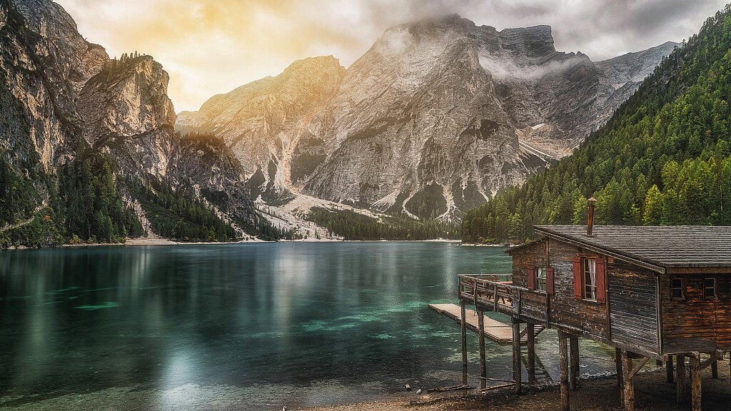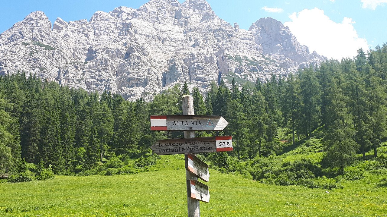
The Alpine Path of the Dolomites no. 1, known as the "classical", is developed along a 12-stage route of about 125 km that connects Braies Lake with Belluno. Crossing the heart of the Dolomites, in their central part, from Pusteria (in the Province of Bolzano) to the thresholds of the Veneto plain, passing between the Dolomites of Braies, Cortina d'Ampezzo, Val di Zoldo, Agordino and Belluno, this hiking itinerary offers wonderful landscapes and strong emotions. Well marked, the Alpine Path takes place on routes that are not particularly demanding, always equipped in the most difficult sections.
The northernmost part of this Alpine Path of the Dolomites no.1 starts from the charming Braies Lake and goes through the romantic reign of Fanes, as far as the Tofane. Once here, mountain experts will have the opportunity to experience the thrill of safeguarded climbs. Following the easy trail, you will enter the beautiful Zoldo Valley, which pays homage to the regal hugeness of Mt Pelmo. Hiking on the Civetta Group offers the grandest views of all the Dolomites. This fantastic itinerary ends in the green Valbelluna.
Technical data | Alpine Path of the Dolomites no. 1
Start Location: Braies Lake (BZ)
End Location: Belluno
Crossing time: 12 days
Trail length: about 125 km
Shelters on the main route: 15
Bivouacs on the main route: 1
Restoration areas on the road: 6
Longest leg: from Palafavera to Lagazuoi hut - 7th leg, crossing time – 6 hours
Shortest leg: from Braies Lake to Biella hut - 1st leg, crossing time – 3 hours and 30 minutes
Total crossing time: almost 57 hours
Difficulty: medium and high
Total altitude difference uphill: about 7,300 m
Total altitude difference downhill: about 8,400 m
Maximum altitude difference uphill: 1,070 m, Fanes - Lagazuoi - 3rd leg
Maximum altitude difference downhill: 1,900 m, Marmol - Belluno – last leg
Maximum trail altitude: Lagazuoi hut, 2,752 m
Minimum trail altitude: Belluno, 389 m (locality Case Bortot, 568 m)
Dolomite groups along the way: 11
Opening period of the shelters: from June to September
Signs: adequate everywhere
Recommended period: from the end of June to the end of September
Recommended topographic maps | Alpine Path of the Dolomites no. 1
Tabacco maps 1:25.000
- n. 031 “Dolomites of Braies”, for the stretch from the Braies Lake to the Fanes hut
- n. 03 “Cortina d’Ampezzo and Ampezzane Dolomites”, for the stretch from the Biella hut to the Ambrizzola Saddle
- n. 015 “Marmolada-Pelmo-Civetta-Moiazza”, for the stretch from the Falzarego Pass to the Carestiato hut
- n. 025 “Zoldo, Cadorine and Agordine Dolomites”, for the stretch from the Ambrizzola Saddle to
the Màrmol Bivouac
- n. 024 “Prealps and Bellunesi Dolomites”, for the stretch from the Màrmol Bivouac to Belluno
Stages | Alpine Path of the Dolomites no. 1
Stage 1: Braies Lake (BZ) - Biella hut - Croda del Becco
Total altitude difference: 900 m (uphill), 60 m (downhill)
Lenght of the trail: about 6 km
Hiking time: 3 hours and 30 minutes
Signs: no.1
Difficulty: Touristic - Hiking
Stage 2: Biella hut - Fanes hut
Total altitude difference: 565 m (uphill), 830 m (downhill)
Lenght of the trail: about 14 km
Hiking time: 4 hours and 30 minutes
Signs: no. 6 and 7
Difficulty: Touristic
Stage 3: Fanes hut - Lagazuoi hut
Total altitude difference: 1070 m (uphill), 375 m (downhill)
Lenght of the trail: about 11 km
Hiking time: 5 hours
Signs: no.10-11, 20b, 20
Difficulty: Trekking
Stage 4: Lagazuoi hut - Nuvolau hut
Total altitude difference: 636 m (uphill), 810 m (downhill)
Lenght of the trail: about 15 km
Hiking time: 5 hours and 30 minutes
Signs: no. 20, 401, 402, 403, 412, 440
Difficulty: Trekking
- Alternative Route I: through the Gallery of Castelletto
Stage 5: Nuvolau hut - Città di Fiume hut
Total altitude difference: 260 m (uphill), 915 m (downhill)
Lenght of the trail: about 11 km
Hiking time: 4 hours and 30 minutes
Signs: no. 438, 443, 436, 458, 467
Difficulty: Trekking – Equipped Trekking – climbing from Nuvolau hut to Giau Pass
- Alternative Route II: from the Nuvolau hut to the Fiume hut through the Cinque Torri hut and the Croda da Lago Palmieri hut
Stage 6: Città di Fiume hut - Venezia hut - Palafavera
Total altitude difference: 580 m (uphill), 990 m (downhill)
Lenght of the trail: about 12 km
Hiking time: 5 hours and 30 minutes
Signs: no. 480, 472, 474
Difficulty: Hiking – Equipped Trekking with climbing along the Gino Flaibani path
- Alternative Route III: from the Città di Fiume hut to the Staulanza Pass
- Alternative Route IV: from the Fiume hut to the Venezia hut and Palafavera
- Alternative Route V: from the Fiume hut to the Coldai hut through the Casèra Bèla Mont or Vescovà and Pioda
Stage 7: Palafavera - Coldai hut - Tissi hut - Vazzoler hut
Total altitude difference: 850 m (uphill), 650 m (downhill)
Lenght of the trail: about 14 km
Hiking time: 6 hours
Signs: no. 564, 556, 560 (563)
Difficulty: Hiking
Stage 8: Vazzoler hut - Carestiato hut
Total altitude difference: 550 m (uphill), 430 m (downhill)
Lenght of the trail: about 8 km
Hiking time: 4 hours
Signs: no. 555, 554
Difficulty: Hiking
Stage 9: Carestiato hut - Sommariva al Pramperét hut
Total altitude difference: 450 m (uphill), 430 m (downhill)
Lenght of the trail: about 13 km
Hiking time: 5 hours
Signs: no. 549, (SS 347), 543
Difficulty: Hiking
- Alternative Route VI: from the Duran Pass hut to the Sommariva al Pramperét hut
Stage 10: Sommariva hut - Pian de Fontana hut
Total altitude difference: 540 m (uphill), 760 m (downhill)
Lenght of the trail: about 6 km
Hiking time: 3 hours
Signs: no. 514
Difficulty: Trekking
Stage 11: Pian de Fontana hut - Marmol Bivouac
Total altitude difference: 830 m (uphill), 195 m (downhill)
Lenght of the trail: about 6 km
Hiking time: 4 hours
Signs: no. 514
Difficulty: Trekking – Equipped Trekking with climbing along Marmol ( I and II grade)
- Alternative Route VII: from the Pian de Fontana hut to the Bianchet hut, the Val Vescovà and the SS Agordino Road
Stage 12: Marmol Bivouac - 7° Alpini hut, towards Belluno crossing the locality of Case Bortot
Total altitude difference: 100 m (uphill), 1,570 m (downhill to Casa Bortot), 1,770 m (downhill to Bolzano Bellunese), 1,900 m (downhill to Belluno)
Lenght of the trail: about 9 km
Hiking time: 5 hours to the locality of Casa Bortot, 7 hours to Belluno
Signs: no. 514, 503, 501
Difficulty: Trekking – Equipped Trekking with via ferrata along Marmol
N.B. Before starting the itinerary, it is advisable to find out about the weather and verify the opening of the shelters and their availability.